Knowledge Base
What is a 3D Point Cloud?
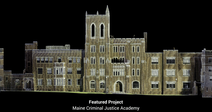
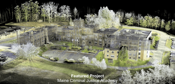
3D point clouds represent a critical aspect of reality capture, providing a precise and detailed snapshot of the spatial conditions of a building or space. These point clouds consist of millions of individual points, each accurately positioned in X, Y, and Z coordinates, and often accompanied by greyscale or color information. This comprehensive data capture method is particularly valuable when integrated with modeling software like Revit.
Data Generation with 3D Laser Scanners
The foundation of 3D point cloud data lies in the technology of 3D laser scanners. These devices, utilizing LiDAR technology, employ visible light to capture intricate information about a given space. The accuracy and clarity of the resulting point cloud depend heavily on the quality of the scanning equipment in use. When employing high-quality instruments, such as the ones utilized by our team, the outcome is an exceptionally precise, high-definition point cloud.

Enhancing Situational Awareness
This laser-accurate, 3D point cloud technology is instrumental in providing clients with a profound understanding of their building or site. It offers insights into various aspects, including site scape information, proximity to neighboring structures, structural concerns like sagging floors, bowing walls, deflected beams, cracked foundations, and anything within the scanner's line of sight. This wealth of data can be efficiently evaluated using Building Information Modeling (BIM) software like Revit.
Historical Record and Versatility
Many of our clients leverage 3D point cloud data as a valuable historical record of their building or site's conditions at the time of the survey. This data serves multiple purposes, including historical preservation efforts, legal documentation for property disputes or regulatory compliance, construction progress surveys to monitor changes over time, and more.
By downloading point cloud data, clients gain access to a treasure trove of information that empowers them to make informed decisions, address structural issues, and enhance project planning and management.

Existing Conditions 3D Laser Scanning Services
Over the past 27 years, we have measured, documented, and modeled over 10,000 buildings spanning over 700 million square feet across the United States, establishing ourselves as an industry leader in 3D laser scanning. Architects, builders, engineers, developers, facility managers, trust us to deliver digital representations of the as-built environment with unparalleled accuracy and efficiency. Our dedicated Project Managers provide fast and accurate 3D laser scanning services and drone imagery services, and expert CAD and BIM technicians create custom, detailed deliverables. Our greatest reward remains delivering superior-quality scan-to-BIM work and knowing we played a vital role in our clients’ unique and historic projects.
Related Articles


.svg)


