

3D Laser Scanning Services
Accurate. Fast. Realiable.
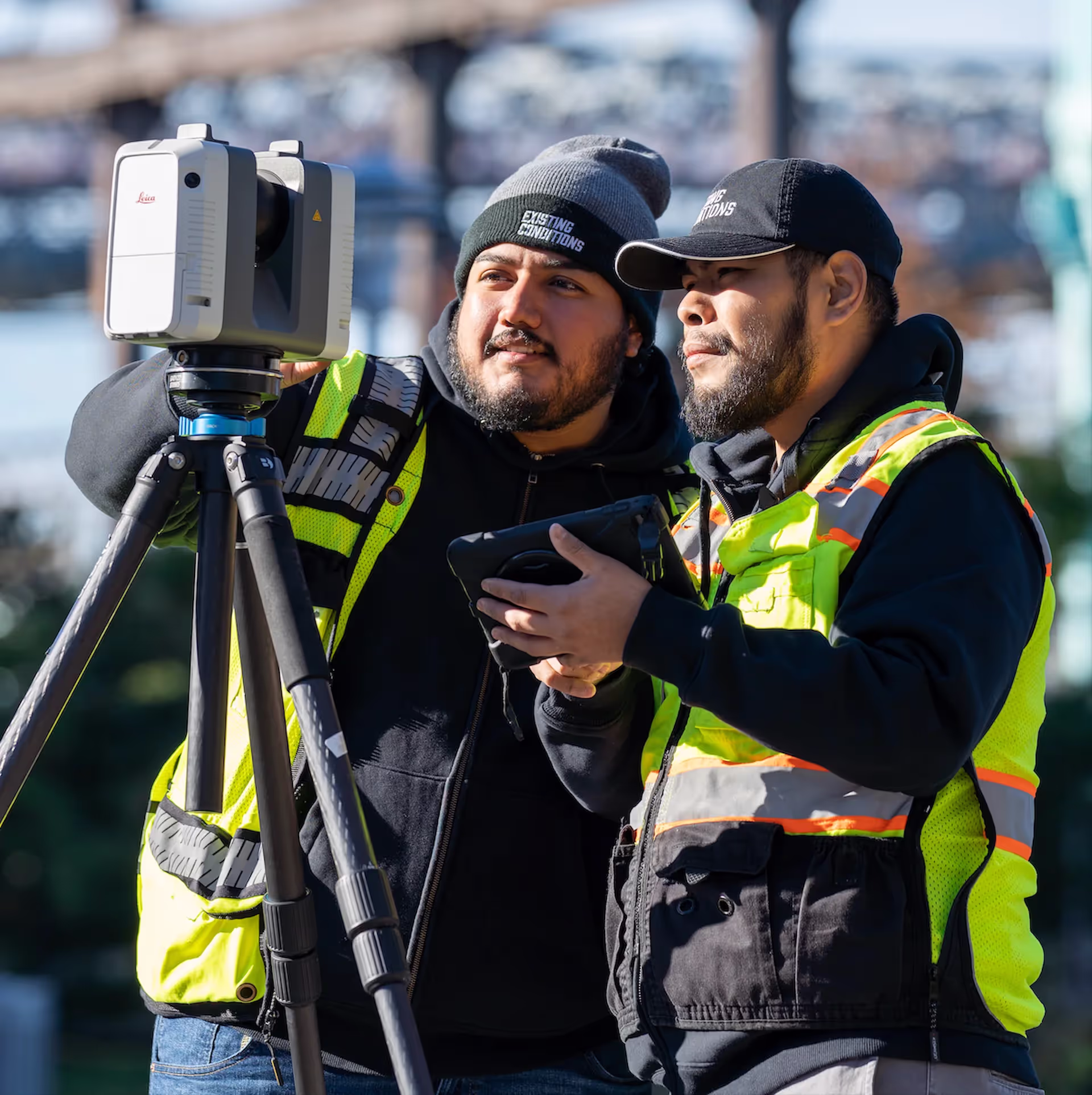
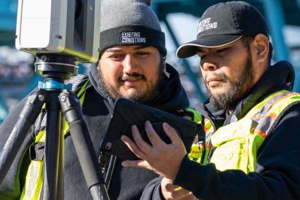
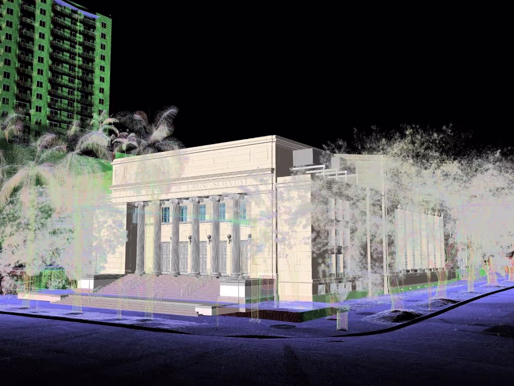
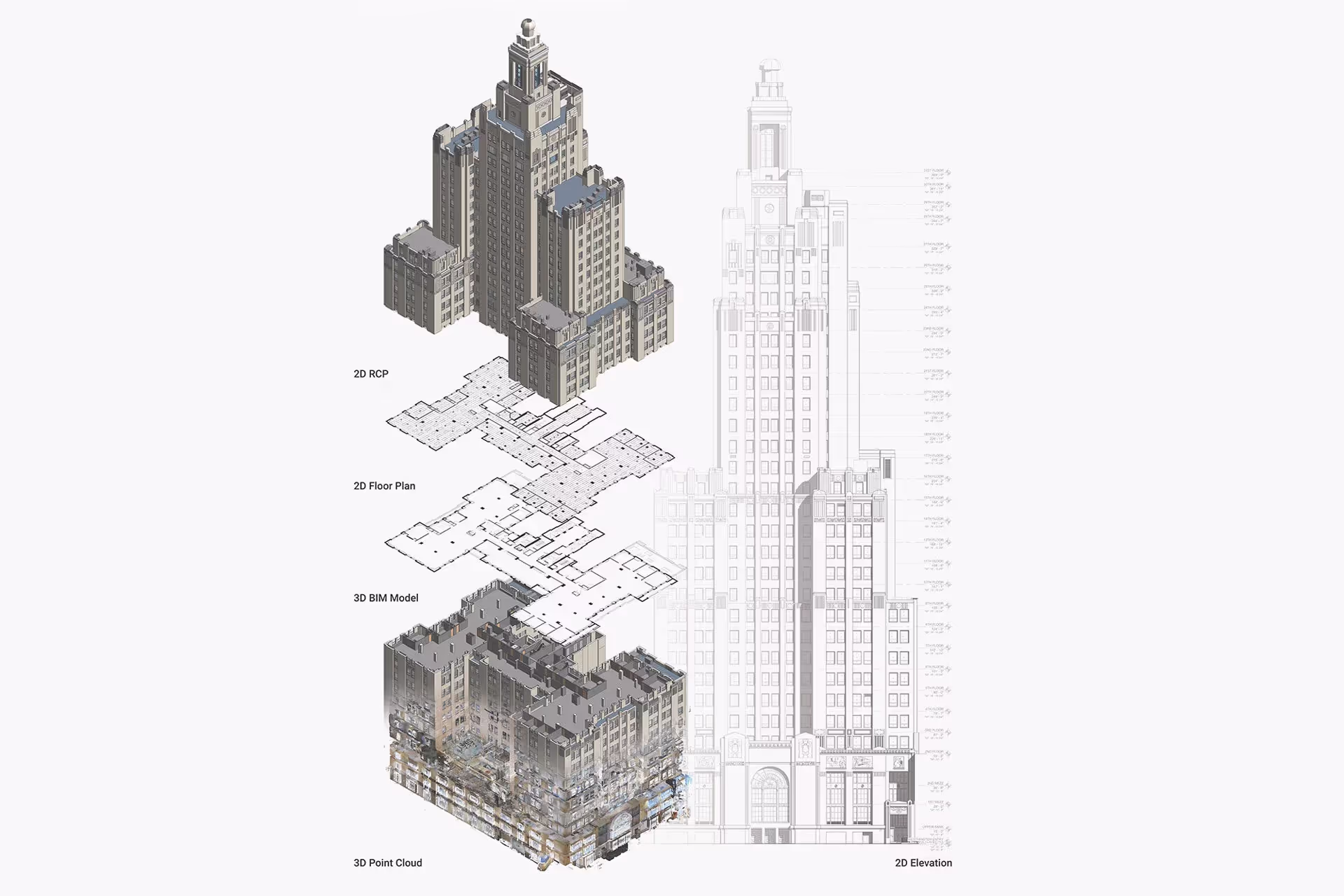
We capture existing conditions and deliver accurate 3D BIM models using advanced LiDAR technology for the architecture, engineering, and construction industries. Our process ensures ±2 mm accuracy and seamless integration into CAD and BIM environments for efficient design and planning.
You receive tailored deliverables that help your team plan, design, and build with confidence. These include:
- High-density point clouds
- 2D CAD drawings for reliable plan development
- 3D BIM models for design coordination and clash detection throughout the project lifecycle
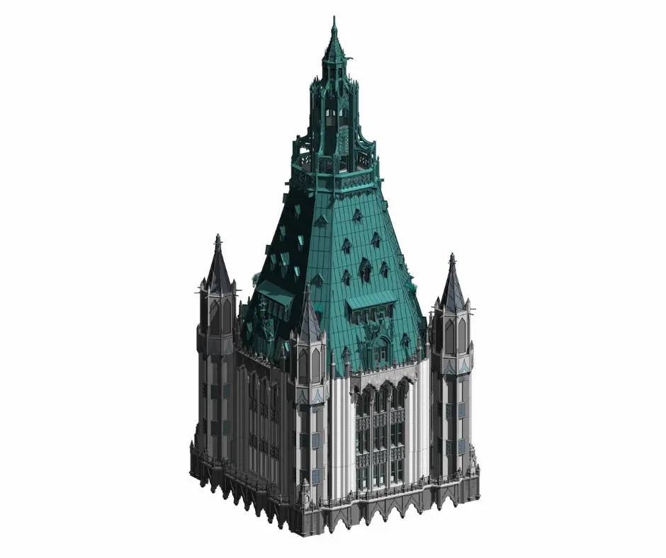
- Textured mesh models for visualization, analysis, animation, and 3D printing
- TruViews for immersive panoramic site review
- Virtual site tours for remote collaboration and stakeholder engagement
.avif)
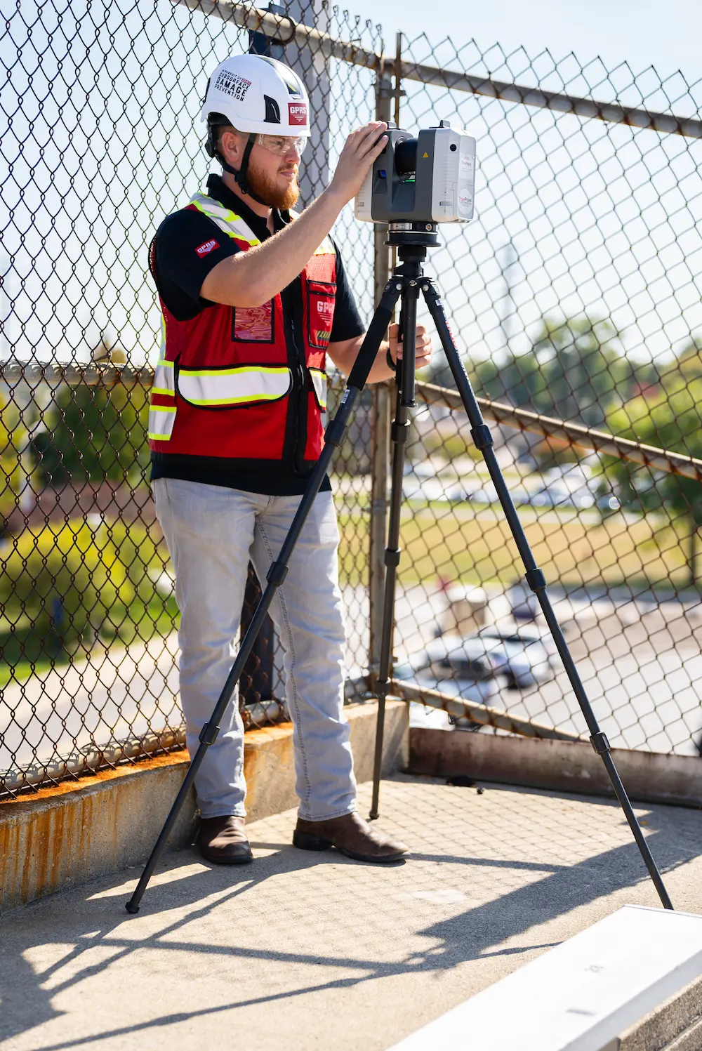
Capture Highly Detailed and Accurate Digital Measurements of Buildings and Infrastructure


Reasons to Use 3D Laser Scanning for Your Projects
Millimeter-Level Accuracy
Achieve ±2 mm precision using LiDAR-based terrestrial scanning. This helps avoid costly mistakes. These errors can cause change orders that normally range from $5,000 to $50,000 for each conflict. Our high-resolution point clouds provide a complete 360° view of walls, floors, ceilings, and structural elements. This ensures that every dimension matches real-world conditions with construction-grade accuracy.
Comprehensive Data Capture
Collect over 1 million data points each second. This creates dense point clouds that capture every surface detail of existing conditions.
Accelerated Project Timelines
Reduce field time and paperwork by up to 70%. This speeds up design validation and construction workflows. By collecting all site data during one visit, teams can avoid unnecessary trips. This minimizes schedule disruptions.
Early Clash Detection
Identify conflicts between existing conditions and proposed designs with 99.8% reliability. This prevents costly rework and delays. Scan-to-model comparisons help engineers and architects ensure their designs match actual site conditions. This validation occurs before fabrication begins.
Cost Reduction
Minimize change orders, rework, and material waste with accurate as-built data. Projects using 3D laser scanning report 50% fewer change orders and overall project cost savings of 5-15%.
Enhanced Collaboration
Share TruViews and virtual site tours for remote stakeholder engagement. This reduces travel costs and improves decision-making. These immersive tools allow teams to review existing conditions in detail without needing to physically be on-site, accelerating approvals and designs.
3D Laser Scanning Applications & Use Cases
Renovations
.svg)
New Construction
Historic Preservation
Healthcare & Pharmaceutical
Academic Institutions
Office Buildings
3D Laser Scanning Applications & Use Cases
Renovations
New Construction
Historic Preservation
Healthcare & Pharmaceutical
Academic Institutions
Reasons to Choose Our 3D Laser Scanning Company
- Proven Experience: Since 1997, we've documented over 10,000 buildings and 800 million square feet across the U.S.
- Industry Expertise: Our team brings extensive experience in the building industry, having worked at architecture firms and served as BIM managers, so we understand the language of buildings.
- Rapid Mobilization: We can be on-site within 5–7 business days, with local Project Managers ready to scan your site.
- Unmatched Accuracy: Our construction-grade LiDAR scanners capture 2 million data points per second with 4–6mm accuracy.
- Expert Team: Project Managers nationwide trained with 440+ hours of classroom, field, and LiDAR instruction.
- Custom Deliverables: Our in-house Mapping & Modeling team creates custom as-builts, 2D CAD drawings, 3D BIM models, 3D mesh models, virtual tours, built to your specs.
- SiteMap® Platform: Our secure, cloud-based platform and app stores your project data in one interactive tool for easy access and file sharing.
- Project Expertise: We’ve worked with many clients across the U.S., completing historic preservation, adaptive reuse, fine homes and multifamily residential, office and retail spaces, infrastructure upgrades, manufacturing, energy, logistics, water treatment, healthcare, and education projects.
.webp)
Start Accurate. Stay Accurate.

Trusted Partner
Expert Team

Comprehensive Data Capture

As-Built Drawings & 3D BIM Models
Industries We Serve

Architecture
Informed design starts with verified conditions, accurate spatial data, and coordinated BIM — so you can focus on what you do best: eliminate site uncertainty, speed up timelines, and skip manual measurements.

Construction
Operational efficiency through accurate as-builts, reduced downtime, and smarter asset tracking, paired with ongoing management via digital twins, up-to-date facility data, and fewer costly site visits.

Facilities Management
Boost operational efficiency with accurate as-builts, minimized downtime, and smarter asset planning and support ongoing management with digital twins, up-to-date data, and fewer costly site visits.

Engineering
Quality design through precise as-builts, advanced analysis, and tighter tolerances protect your reputation by delivering accurate BIM models that keep projects on time, on budget, and safe.

Real Estate
Stay on time with accurate documentation, rapid data capture, and efficient coordination - stay on budget by reducing rework, repeat visits, and improving cost and schedule accuracy with trusted data.

Entertainment
Production planning made easy with millimeter-accurate scans, verified as-builts, and precise coordination, enhanced by training and simulation using VR, real-world environments, and laser-accurate spatial data.

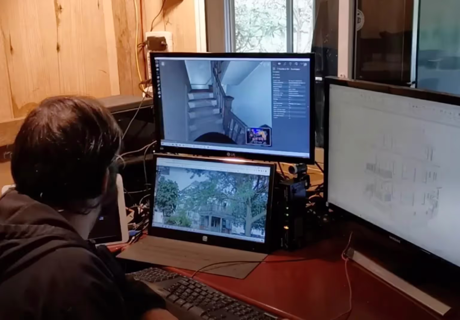
Our 3D Laser Scanning Process

.jpg)
Case Studies

"Superman" Building
.avif)
Independence Wharf

Boston College Alumni Stadium
Frequently Asked Questions
What is As-Built Documentation?
As-built documentation is an accurate set of record drawings for a project. They reflect all changes made during the construction process and show the exact dimensions, geometry, and location of all building elements and infrastructure.
What is LiDAR?
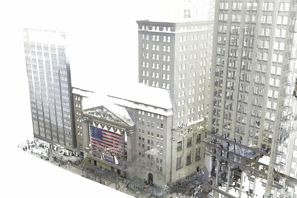
LiDAR, which stands for Light Detection and Ranging, is a remote sensing method used to generate precise, three-dimensional information about the shape of an object and its surface characteristics. 3D laser scanners utilize LiDAR technology to precisely capture the three-dimensional data of a structure or site. LiDAR operates by emitting light as a pulsed laser to measure distances to a target. When these laser pulses bounce back to the scanner, the distances are recorded, mapping the spatial geometry of the area. This process collects millions of measurement points, each with x, y, and z coordinates, forming what is known as a point cloud.
What is Terrestrial Laser Scanning?
Terrestrial laser scanning uses a tripod-based laser scanner to capture highly accurate data on buildings, structures, equipment, utilities, and processes to plan for construction, renovation, and modifications. Terrestrial laser scanning is a non-contact and non-destructive technology that digitally captures the shape of physical objects using laser light. In addition, it can capture digital photos of the same area being scanned, which can be used to create photorealistic 3D models.
What is a 3D BIM Model?
A building information model (BIM) is a digital representation of the physical and functional characteristics of a building or infrastructure project. BIM stores all the information about a building's life cycle in one place, including design, construction, and operational data, which can be used for planning, renovation, and maintenance. It provides accurate spatial relationships and manufacturer details, as well as geographic information and other pertinent aspects of the building.
What is 3D Laser Scanning?
3D laser scanning captures the as-built documentation of existing buildings or sites. Data is acquired with a 3D laser scanner equipped with LiDAR technology in the form of a point cloud and is used to develop 2D CAD drawings or 3D BIM models, expediting the design, planning, and development of architecture, engineering, and construction projects.
How Accurate is the Point Cloud and BIM Model?
Point clouds are a digital representation of spatial information, stored as a collection of points with three spatial coordinates. They are millimeter-accurate and are scanned in the level of detail required for your project. BIM model features are created to your project-specific scope, LOD specifications can vary throughout the model. By specifying scope and project details, BIM models can be customized to your project.
What Industries Benefit from 3D Laser Scanning?
Industries like construction, architecture, and engineering benefit from 3D laser scanning. It helps with accurate as-built documentation and BIM integration. Manufacturing and industrial plants use it for quality control and reverse engineering. Healthcare and pharmaceutical sectors rely on scanning for compliance and cleanroom validation. Historic preservation projects use it to make digital archives of heritage sites. Academic institutions utilize it for campus planning, research, and facility management. Real estate, oil and gas, and utilities also leverage scanning for asset management and safety inspections.


