

Reality Capture Data to Start Accurate, and Stay Accurate™
By converting real‑world conditions into millimeter-accurate digital files, reality capture technology ensures your team designs from verified building information.
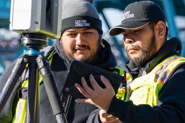
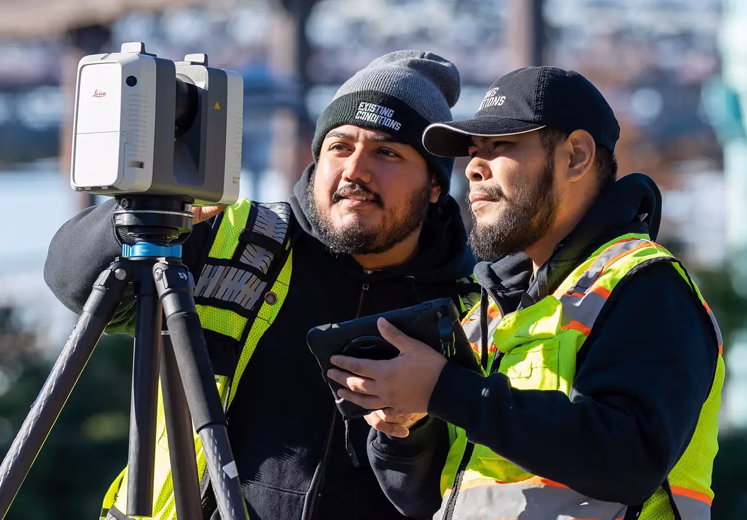
Existing Conditions' Reality Capture Services use construction‑grade 3D laser scanners and LiDAR‑based photogrammetry cameras to create exact digital models of sites, buildings, and infrastructure.
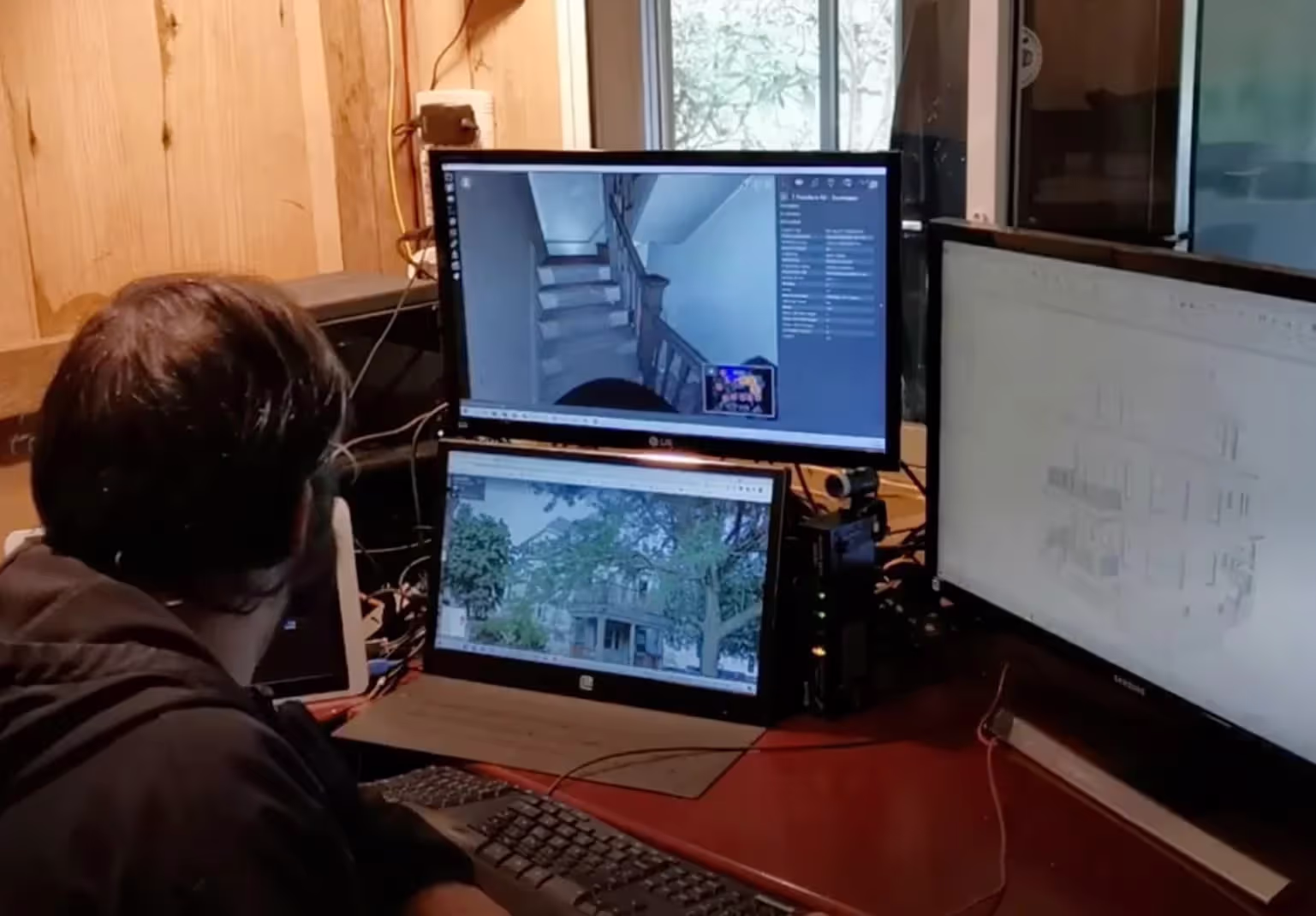
Our Project Managers deliver LiDAR point clouds and 4K HDR images that can be integrated with AutoCAD and Autodesk Revit, supporting scan-to-CAD and scan-to-BIM workflows.
With trusted 3D site information, you avoid inaccurate measurements, outdated documentation, design clashes, costly rework, and project delays.


What is Reality Capture?

Reality Capture = Accuracy + Efficiency
Reality capture delivers measurable results: 80% of leading construction firms report an increase in efficiency after adopting reality capture services, while 73% of AEC firms say client satisfaction improves when projects are built from verified digital data. By transforming real world conditions into precise 3D models, reality capture eliminates costly errors, reduces rework, and accelerates project timelines, making accuracy and efficiency not just promises, but proven outcomes.
Equipment for Reality Capture
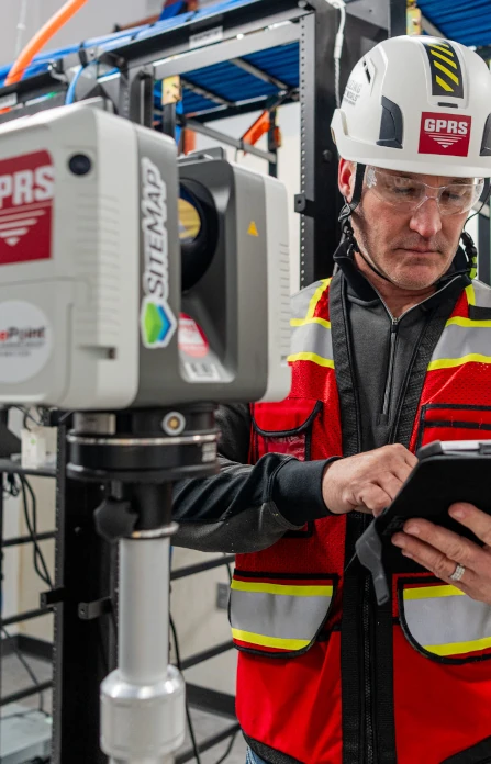
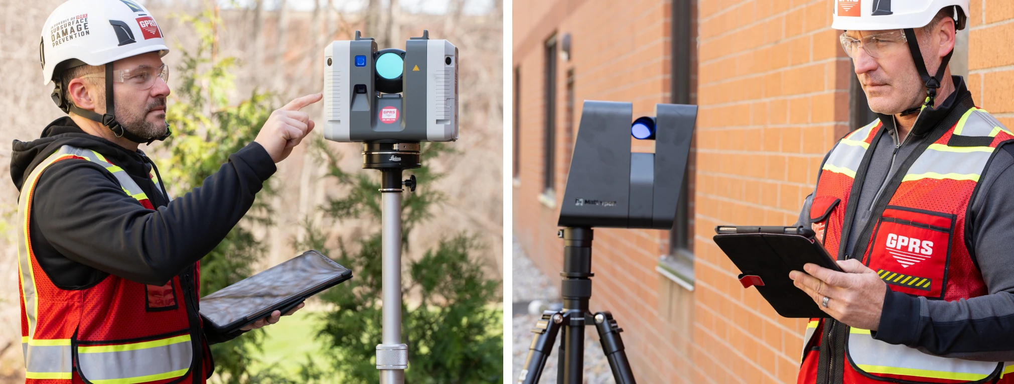
3D Laser Scanners
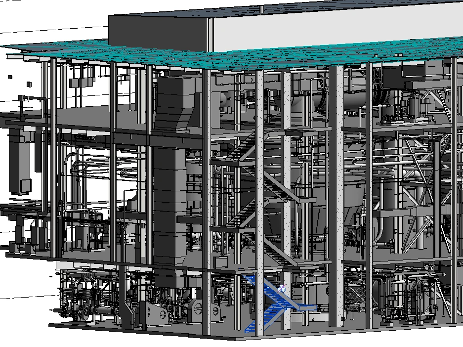
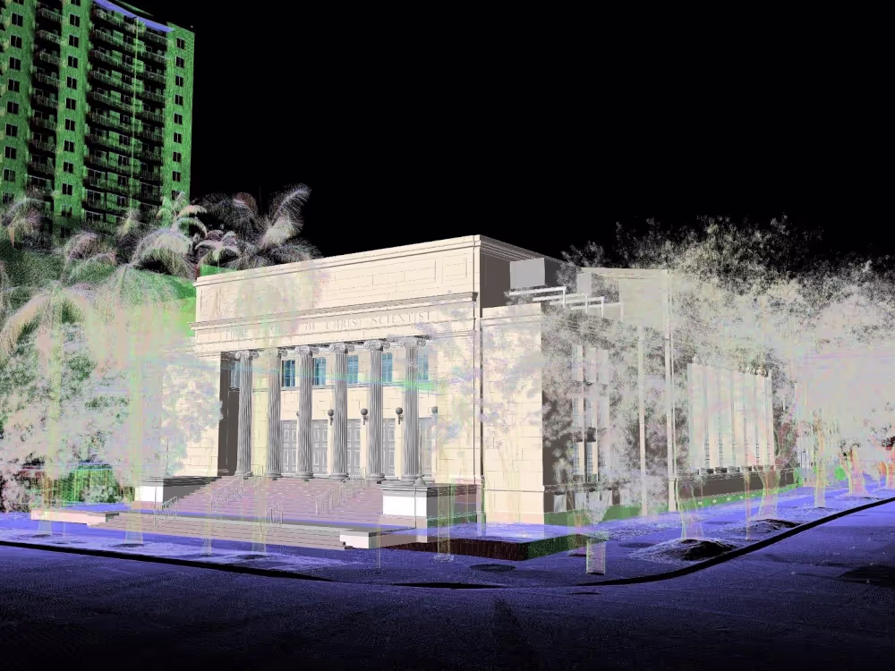
3D laser scanners uses LiDAR technology to capture architectural, structural, and MEP dimensions of buildings, facilities, and sites with 2–4 mm accuracy, recording millions of data points from multiple angles. Each point, defined by exact x, y, and z coordinates, is processed into a point cloud to create an accurate 3D representation of a site. Point clouds can be used to create 2D CAD drawings, 3D BIM models, 3D meshes, TruViews, and virtual tours of the highest quality standards.
Photogrammetry
Photogrammetry uses cameras equipped with LiDAR to capture high‑resolution 4K HDR photographs of buildings, facilities, and sites. The 3D rendered images can be used to create virtual tours, floorplans, topographic maps, point clouds, 3D models, and more for planning, analysis, and calculations.
Risks Eliminated by Reality Capture
Outdated Documentation
Existing drawings and models often fail to reflect current site conditions. Reality capture updates outdated building records with accurate documentation for precise design planning.
Change Orders & Rework
Inaccurate or incomplete data can lead to change orders, rework, and material waste. Reality capture reduces these risks by providing millimeter-accurate verified as-built data. A landmark joint study by PlanGrid and FMI quantified the issue: roughly 48% of all rework in U.S. construction is caused by poor data and miscommunication.
Clashes & Prefabrication Errors
Without accurate 3D data, MEP system updates may conflict with structural or architectural elements, and prefabricated components may not fit correctly. Reality capture enables clash detection to prevent costly field modifications and ensures precise off-site fabrication.
Project Delays
Manual measurements can take weeks, while reality capture documents existing building conditions in hours. Faster documentation accelerates timelines and project delivery.
Hidden Infrastructure Risks
Reality capture documents infrastructure such as pipes, conduits, and ductwork before walls or ceilings cover them, reducing the risk of damaging existing systems during renovations or retrofits.
Trade Coordination Issues
Miscommunication between trades often causes conflicts. Reality capture data provides a single source of truth for all trades.
Ongoing Facility Management
Missing or inaccurate records make future renovations, retrofits, and maintenance more difficult. Reality capture creates a permanent digital record for long‑term facility management.
Compliance & Safety Risks
Accurate digital records confirm building code compliance, safety standards, and regulatory requirements throughout the project lifecycle.


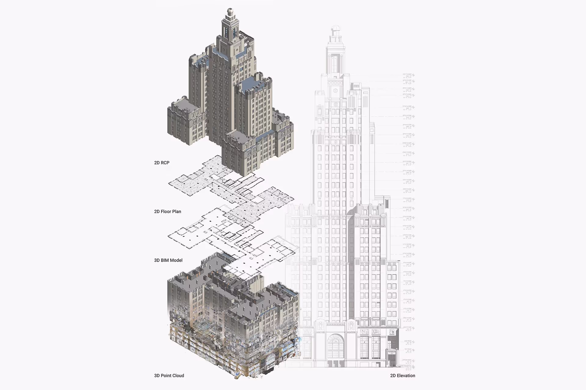
Reality Capture Deliverables Customized for Your Project
Point Cloud Data
.svg)
2D CAD Drawings
3D BIM Models
3D Mesh Model
TruView
3D Virtual Tour
Reality Capture Deliverables Customized for Your Project
Point Cloud Data
2D CAD Drawings
3D BIM Models
3D Mesh Model
TruView
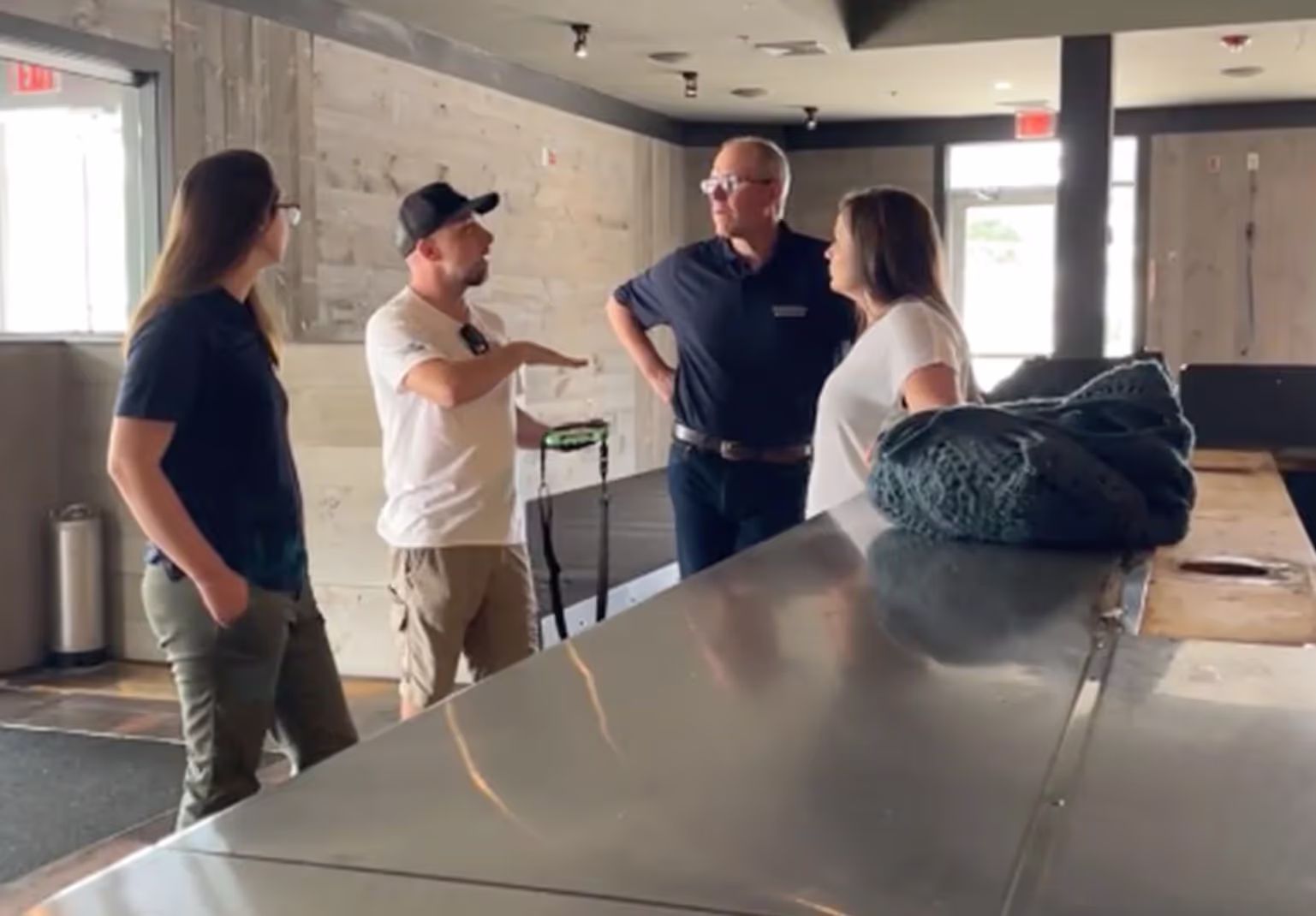
Reasons to Choose Existing Conditions for Reality Capture
Proven Experience
Since 1997, we’ve delivered reality capture services for more than 10,000 buildings, documenting over 800 million square feet across the United States.
Rapid Mobilization
Our reality capture company can be on-site within 5–7 business days, with local Project Managers near you ready to document your site.
Unmatched Accuracy
Our construction-grade 3D laser scanners capture 2 million data points per second with 2-4mm accuracy. Photogrammetry offers 20mm accuracy within a 10m range.
Expert Team
We have over 500 SIM-certified Project Managers nationwide trained with 440+ hours of classroom, field, and LiDAR instruction.
Custom Deliverables
Our in-house Mapping & Modeling Team creates custom as-builts drawings, 3D BIM models, 3D mesh models, virtual tours, and digital twins, built to your specs.
SiteMap® Platform
SiteMap, our secure, cloud-based platform and app stores your 3D laser scan and photogrammetry data in a user-friendly interface for easy access and file sharing.

Start Accurate. Stay Accurate.

Trusted Partner
Expert Team

Comprehensive Data Capture

As-Built Drawings & 3D BIM Models
Industries We Serve

Architecture
Informed design starts with verified conditions, accurate spatial data, and coordinated BIM — so you can focus on what you do best: eliminate site uncertainty, speed up timelines, and skip manual measurements.

Construction
Operational efficiency through accurate as-builts, reduced downtime, and smarter asset tracking, paired with ongoing management via digital twins, up-to-date facility data, and fewer costly site visits.

Facilities Management
Boost operational efficiency with accurate as-builts, minimized downtime, and smarter asset planning and support ongoing management with digital twins, up-to-date data, and fewer costly site visits.

Engineering
Quality design through precise as-builts, advanced analysis, and tighter tolerances protect your reputation by delivering accurate BIM models that keep projects on time, on budget, and safe.

Real Estate
Stay on time with accurate documentation, rapid data capture, and efficient coordination - stay on budget by reducing rework, repeat visits, and improving cost and schedule accuracy with trusted data.

Entertainment
Production planning made easy with millimeter-accurate scans, verified as-builts, and precise coordination, enhanced by training and simulation using VR, real-world environments, and laser-accurate spatial data.

Our 3D Laser Scanning Process
.jpg)
Articles
.avif)
What is LiDAR?

What Is 3D Laser Scanning?
Case Studies

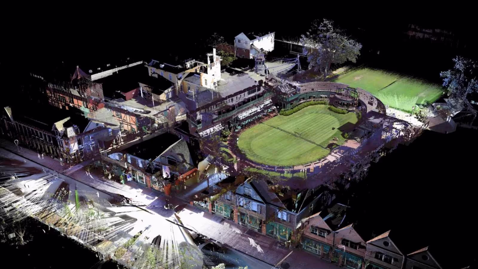
Woolworth Building Pinnacle Penthouse

Williams College
-1%20(1).webp)
Frequently Asked Questions
What is Reality Capture and How Does It Work?
Reality capture is the process of digitally collecting physical site conditions using tools like 3D laser scanners, LiDAR, drones, and photogrammetry. These technologies generate point clouds and high‑resolution imagery that can be converted into CAD or BIM models. The result is a precise digital twin of the physical environment.
What are the Benefits of Using Reality Capture in AEC Projects?
AEC firms adopt reality capture to eliminate guesswork, reduce risk, and accelerate project delivery. Verified digital data improves collaboration, prevents design clashes, and reduces costly rework.
Which Technologies are Used for Reality Capture and How Do I Choose the Right One?
Reality capture relies on advanced technologies, each suited to different project needs:
- Construction-Grade 3D Laser Scanners: These devices use laser beams to measure millions of points with millimeter level accuracy. They’re ideal for detailed interior scans, complex mechanical spaces, and projects where precision is critical.
- Photogrammetry Software: This technology stitches together overlapping photographs to generate 3D models. It’s cost effective and works well for visual documentation, though it’s less precise than laser scanning.
Choosing the right technology depends on:
- Project Scale: Large infrastructure vs. small interior spaces.
- Required Accuracy: Millimeter precision for engineering vs. broader visuals for planning.
- Workflow integration: Compatibility with CAD, BIM, or GIS platforms like AutoCAD, Revit, or Civil 3D.
- Budget and Timeline: Construction-grade 3D laser scanners deliver unmatched accuracy but may be more costly; photogrammetry offer faster, more economical options.
What is LiDAR?
LiDAR, which stands for Light Detection and Ranging, is a remote sensing method used to generate precise, three-dimensional information about the shape of an object and its surface characteristics. 3D laser scanners utilize LiDAR technology to precisely capture the three-dimensional data of a structure or site. LiDAR operates by emitting light as a pulsed laser to measure distances to a target. When these laser pulses bounce back to the scanner, the distances are recorded, mapping the spatial geometry of the area. This process collects millions of measurement points, each with x, y, and z coordinates, forming what is known as a point cloud.
How Much Does 3D Laser Scanning Cost?
The cost of 3D laser scanning services at Existing Conditions is determined by the specific scope, complexity, and deliverable requirements of each project. Our team provides customized quotes based on factors such as square footage, site accessibility, level of detail, and modeling outputs. Using survey-grade laser scanners, our Project Managers capture precise spatial data with millimeter-level accuracy, documenting architectural, structural, and MEP systems.
Deliverables can include raw point clouds, 2D CAD drawings, 3D BIM models, 3D mesh geometry, TruViews, and immersive virtual tours, all tailored to the required Level of Detail (LOD). For more information about our 3D laser scanning, scan-to-BIM services, or to request a quote, please contact Existing Conditions at email@existingconditions.com or 617-247-9161.
How Accurate is the Point Cloud and BIM Model?
Point clouds are a digital representation of spatial information, stored as a collection of points with three spatial coordinates. They are millimeter-accurate and are scanned in the level of detail required for your project. BIM model features are created to your project-specific scope, LOD specifications can vary throughout the model. By specifying scope and project details, BIM models can be customized to your project.
How is 3D Laser Scan Data Processed?
Once a site is scanned, we process the raw point cloud data by combining individual scans. We remove unwanted noise and convert the data into usable formats like 2D drawings or 3D models. The level of detail depends on the project’s needs, ranging from basic visuals to complex models. Existing Conditions follows a structured workflow focused on accuracy, teamwork, and planning. We ensure efficient project execution. Our deliverables are high-quality and tailored to each client's needs.


