

Knowledge Base
What is the Difference Between 3D Point Clouds vs. 3D BIM Models?
3D point clouds are composed of millions of points at the correct X, Y, and Z coordinates with greyscale or color information assigned. This form of Reality Capture represents the precise as-built condition of a building or space and works best with modeling software such as Autodesk Revit. Point clouds are produced by 3D laser scanners, which measure the physical dimensions of the visible surfaces of buildings and objects around them.
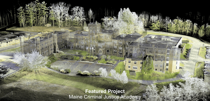
While point clouds provide a tremendous amount of data, the points are not "intelligent" insofar as they are not associated with specific elements such as 'walls', 'floors', 'doors', 'windows', 'roofs', etc. There are no lines, surfaces, or other modeled elements within a point cloud, only points. However, these millions of little points become the backbone for a variety of processes, including the creation of architectural drawings and 3D Building Information Models (BIM).
There are currently no reliable processes for automating the creation of BIM models from the point cloud data. The model cannot simply be generated directly from the raw data collected on-site. Instead, the modeling process takes time and expertise in deciphering the different elements in the processed scan data and then modeling what elements are part of the scope of work. This requires a trained professional to model on top of the data which serves as a template for their work. This process removes any doubt as to the accuracy of a BIM model since the point cloud acts as a visual check against the actual site conditions which produces confidence in the reliability of the model.
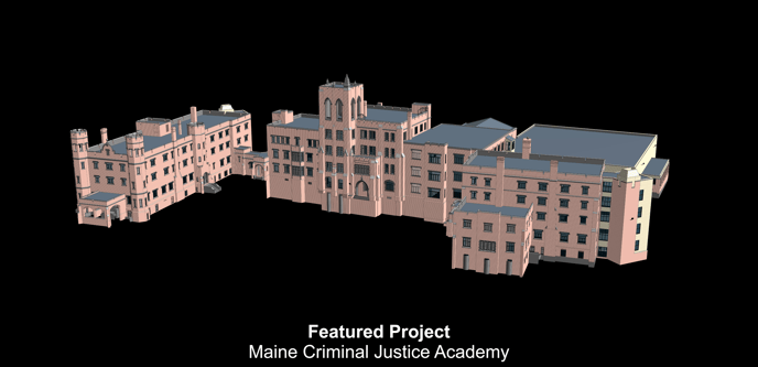
In contrast to the 3D point cloud data, a BIM model provides a digital representation of the actual building. This is known as a "digital twin". Elements in the 3D model have sizes and properties that can be scheduled and counted, and database information can be attached for tracking specifications, cost analysis, energy efficiency, maintenance and repair, and much more. This 3D model becomes a shared resource for information about a facility and it forms a reliable basis for decisions during its life-cycle, from as early as the project's conception to its demolition.
The model and drawings that are produced via BIM are separate from the 3D point cloud files and the 3D virtual walk-through files.
When the Existing Conditions crew departs a job site, our team will upload the data to our proprietary cloud network where we begin processing the raw scan data into a single, accurate, cohesive 3D point cloud file. These point cloud files become the basis for creating the 3D model. The modeling process takes significantly more time and energy than the site work and our staff can give you accurate time estimates based on the priorities and scope of work you need for your project.
Related Articles


