

Knowledge Base
How Do We Collect 3D Laser Scanning Field Data?
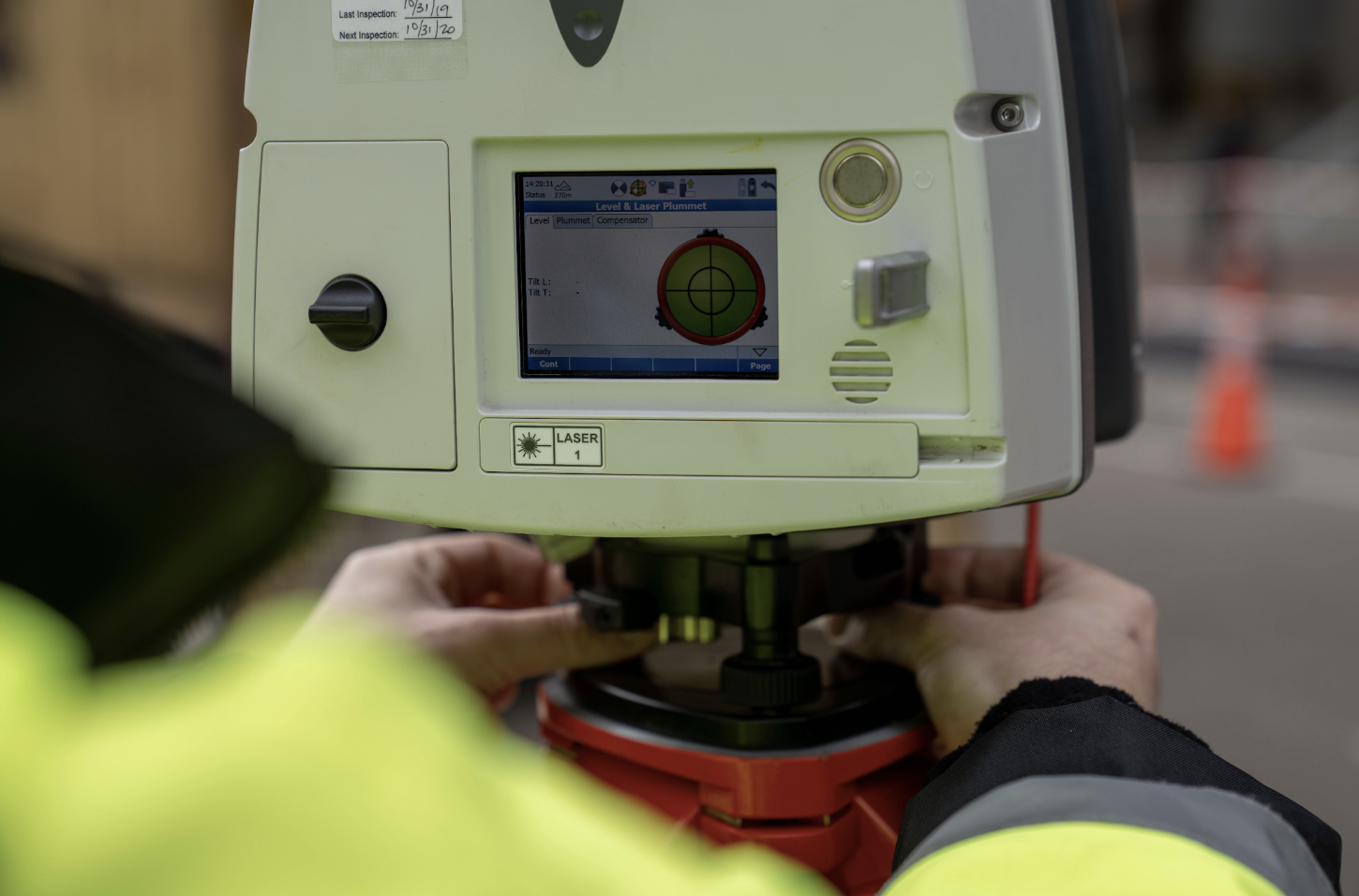
Advanced Field Data Collection with Reality Capture Tools
At Existing Conditions, we are at the forefront of field data collection, harnessing the power of cutting-edge reality capture tools to redefine how we create digital footprints of physical structures. Our primary method for data capture is construction-grade 3D laser scanning, a technology that revolutionizes the way we gather information from sites. Here's a closer look at how this process works.
High-Speed Laser Scanning
Our field data collection process is powered by small and lightweight laser scanning equipment. In less than two minutes, this state-of-the-art technology can capture an astonishing two million data points per second. This rapid data acquisition enables us to gather real-time measurements and a wealth of information directly from the site.
Point Cloud Data
Construction-grade 3D laser scanning automatically generates point cloud data in the field. This rich dataset serves a multitude of purposes, providing architects, designers, and builders with a comprehensive and highly accurate representation of the physical structure.
Diverse Hardware Solutions
To ensure that we meet the unique needs of each project, we utilize a full spectrum of laser scanning equipment sourced from reputable companies such as Leica Geosystems and FARO 3D. Depending on the project's specific requirements, we deploy the hardware that is best suited to the task at hand. Our commitment to using the most advanced and appropriate equipment underscores our dedication to delivering precise and reliable field data.
Learn More About Our Hardware
For a deeper understanding of the hardware we employ in our field data collection processes, you can explore our detailed resources to learn more about the hardware we use to collect field data. Read about LIDAR or learn more about phase-based scanning.
Existing Conditions 3D Laser Scanning Services
Over the past 27 years, we have measured, documented, and modeled over 10,000 buildings spanning over 700 million square feet across the United States, establishing ourselves as an industry leader in 3D laser scanning. Architects, builders, engineers, developers, facility managers, trust us to deliver digital representations of the as-built environment with unparalleled accuracy and efficiency. Our dedicated Project Managers provide fast and accurate 3D laser scanning services and drone imagery services, and expert CAD and BIM technicians create custom, detailed deliverables. Our greatest reward remains delivering superior-quality scan-to-BIM work and knowing we played a vital role in our clients’ unique and historic projects.
Related Articles


