

Knowledge Base
Deformation Maps From 3D Laser Scanning
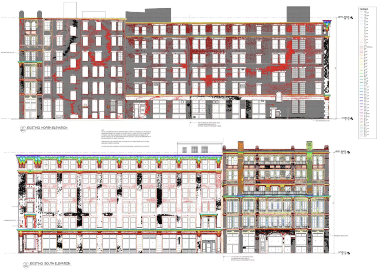
Understanding Deformation Maps
Deformation maps are a valuable tool used in construction and engineering to visualize the topography of a built surface. They provide a clear and detailed representation of the elevation of the floor or surface at various points. These maps serve several crucial purposes:
Identifying Uneven Floors
Deformation maps are particularly useful for identifying and addressing uneven floors. They offer a visual depiction of elevation variations across a floor, helping professionals pinpoint areas where the surface deviates from the desired level.
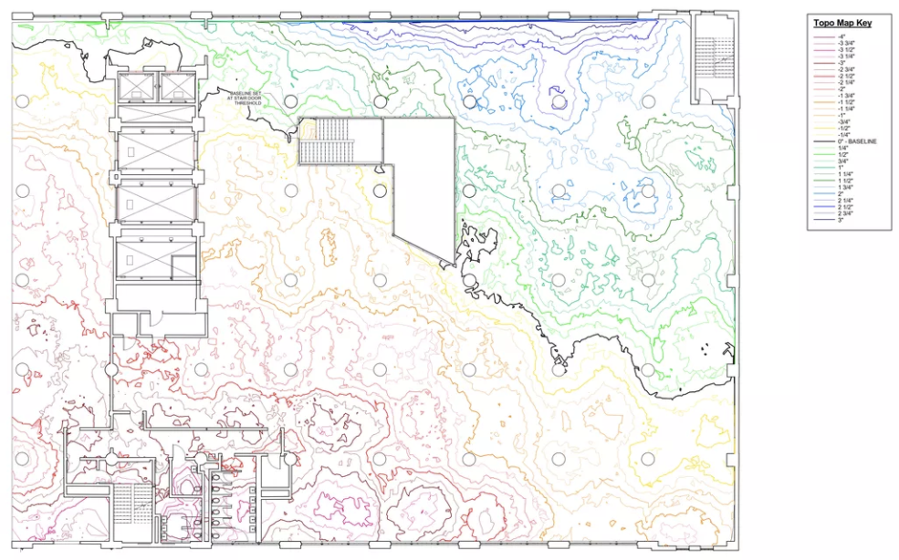
Evaluating Exterior Wall Deflections
In addition to uneven floors, deformation maps can also be applied to exterior walls. They help reveal any deflections or deviations in the wall's alignment. This information is crucial for assessing structural integrity and identifying potential issues that may require correction.
High and Low Points
Much like topography maps used for land, deformation maps display high and low points throughout a building's floors or surfaces. These maps provide a comprehensive view of elevation changes, allowing professionals to identify areas of concern or interest.
Quantifying Concrete Requirements
Deformation maps play a vital role in construction planning. They assist in estimating the amount of concrete needed to level or correct uneven surfaces. By analyzing the elevation data provided by deformation maps, project teams can make informed decisions about materials and resources.
Understanding Structural Impacts
Deformation maps can also reveal the impact of weight and load on a structural system. By visualizing elevation changes caused by heavy loads, engineers can assess the stress on a building's components and make necessary adjustments to ensure structural stability.
In summary, deformation maps are a powerful tool for assessing the topography of built surfaces, whether it's uneven floors, deflected walls, or structural considerations. These as-built drawings offer valuable insights into elevation variations, helping professionals make informed decisions, plan construction projects, and ensure the integrity and safety of buildings.
Existing Conditions 3D Laser Scanning Services
Over the past 27 years, we have measured, documented, and modeled over 10,000 buildings spanning over 700 million square feet across the United States, establishing ourselves as an industry leader in 3D laser scanning. Architects, builders, engineers, developers, and facility managers, trust us to deliver digital representations of the as-built environment with unparalleled accuracy and efficiency. Our dedicated Project Managers provide fast and accurate 3D laser scanning services and drone imagery services, and expert CAD and BIM technicians create custom, detailed deliverables. Our greatest reward remains delivering superior-quality scan-to-BIM work and knowing we played a vital role in our clients’ unique and historic projects.
Related Articles


