

Knowledge Base
What is the Difference Between Terrestrial Scanning vs. SLAM vs. Drone Surveys
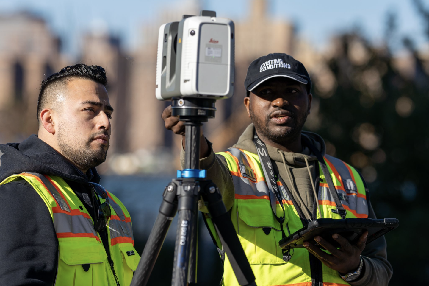
Terrestrial Scanning
Terrestrial laser scanning (TLS), also referred to as terrestrial LiDAR (light detection and ranging) or topographic LiDAR, acquires XYZ coordinates of numerous points on land by emitting laser pulses toward these points and measuring the distance from the device to the target.
A terrestrial laser scanner is used for data collection, as they are able to document vertical structures, such as buildings and facilities. These scanners sit on a tripod and can take 1-3 minutes to complete each scan, depending on the project requirements. Terrestrial laser scanners are known to produce the most accurate point clouds due to the fact that they are stationary. Note that a laser scanner can only capture what is in its field of view. Scanners are positioned around a site and take individual scans from varying viewpoints to capture complete site data. The captured points record everything from surface detail and texture, to color, creating a direct representation of the scanned project site.
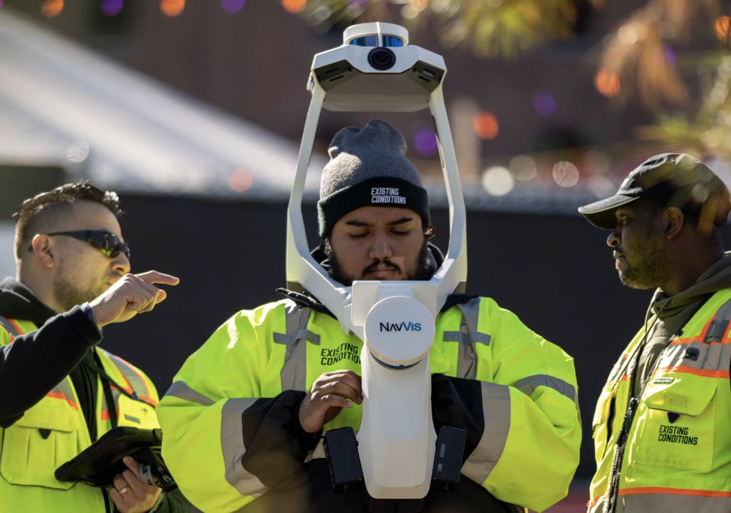
SLAM
Simultaneous localization and mapping (SLAM) is the process of constructing or updating a map of an unknown environment while simultaneously keeping track of an agent's location within it. The Leica BLK2GO is one example of equipment that utilizes this technology. SLAM algorithms are used in navigation, robotic mapping and odometry for virtual reality or augmented reality. SLAM algorithms are tailored to the available resources, hence not aimed at perfection, but at operational compliance. Published approaches are employed in self-driving cars, unmanned aerial vehicles, autonomous underwater vehicles, planetary rovers, newer domestic robots and even inside the human body.
Drone Surveys
Drone Survey Services provide fast and accurate aerial imagery and drone mapping for architecture, engineering, and construction projects. With high-resolution cameras and LiDAR sensors, our drones capture video and images of buildings, sites, and infrastructure, facilitating real-time collaboration and decision-making.
Drones are continually proving to be powerful commercial tools, simultaneously providing adopters with leaps in efficiency and safety. The surveying and mapping industry is no exception. With their ability to capture data from above, drones have been successfully integrated into surveying workflows to perform land surveys, photogrammetry, 3D mapping, topographic surveying, and more.

Existing Conditions 3D Laser Scanning Services
Over the past 27 years, we have measured, documented, and modeled over 10,000 buildings spanning over 700 million square feet across the United States, establishing ourselves as an industry leader in 3D laser scanning. Architects, builders, engineers, developers, and facility managers, trust us to deliver digital representations of the as-built environment with unparalleled accuracy and efficiency. Our dedicated Project Managers provide fast and accurate 3D laser scanning services and drone imagery services, and expert CAD and BIM technicians create custom, detailed deliverables. Our greatest reward remains delivering superior-quality scan-to-BIM work and knowing we played a vital role in our clients’ unique and historic projects.
Contact us today for a free project estimate.
Related Articles


