

Accurate as-built data leads to more accurate plans.
Existing Conditions provides 3D Laser Scanning and BIM Modeling Services to support AEC projects across Michigan, including Detroit, Grand Rapids, Warren, Sterling Heights, and Ann Arbor. We deliver custom point clouds, AutoCAD drawings, and Revit models to help your team plan effectively and build with confidence.
Whether you're working on automotive manufacturing plants, industrial facilities, adaptive reuse, infrastructure upgrades, office buildings, retail spaces, water treatment plants, healthcare facilities, or universities, our precise as-built documentation helps minimize costly errors and accelerate project timelines.
Existing Conditions' 3D Laser Scanning Services help you:
- Visualize and share site conditions remotely
- Expedite site analysis and planning
- Improve design accuracy with precise measurements
- Reduce clashes, errors, and costly rework
- Save time and control project costs
- Enhance collaboration and communication within the project team
Deliverables include:
- High-quality LiDAR point clouds
- Detailed 2D CAD drawings
- Intelligent 3D BIM models
- Interactive TruViews & Virtual Tours
Fill out the form today for a free quote.
Reach Us:
Available 24/7 every day
Available 24/7 every day
How Can We Support Your Project?
At Existing Conditions, we deliver custom 3D laser scanning and BIM deliverables to help architects, builders, engineers, homeowners, and facility managers plan and execute projects with confidence.
Architects
Existing Conditions partners with the most well-known architecture firms in the United States. Architects need accurate documentation to design with confidence, and that's exactly what we deliver. At Existing Conditions, we lay the groundwork for architects. This makes coordination a breeze and eliminates the need for extra site visits. That means architects save time, avoid costly delays, and maintain steady progress on their projects. Architects can focus on creating great designs while we handle the rest.
Learn More
Builders
The last thing contractors need are surprises on-site. That's why Existing Conditions' 3D laser scanning services provide contractors with verified site conditions right from the start. This cuts down on rework and avoids costly change orders. Accurate point clouds and detailed BIM models make it easy to coordinate trades. They help validate layouts and keep project schedules on track. From prefabrication to clash detection, we make sure every piece fits, so projects stay on time and on budget.
Learn More
Engineers
Engineers deserve accurate, reliable data that keeps critical decisions moving forward.That's why we provide engineers with high-precision scans and BIM models that capture every detail of a building's structure and systems. From load calculations to MEP coordination and clash detection, our deliverables make complex workflows easier and more accurate. With Existing Conditions, engineers can design, validate, and move forward with confidence.
Learn More
Homeowners
Planning a renovation or addition? At Existing Conditions, we help homeowners by providing clear, accurate documentation of their home's as-built conditions. Our as-built drawings and 3D models remove guesswork. This helps homeowners and their design teams make informed decisions from the start. With every wall, ceiling, and system captured in detail, you can keep your project running smoothly.
Learn More
Facility Managers
It's easier to manage a building when facility managers have the right information at their fingertips. We create digital twins and detailed as-built documentation that simplify maintenance, space planning, and compliance. Our 3D laser scanning and BIM services provide facility managers with a single, reliable source of truth for facilities or campuses. This makes asset management and future upgrades stress-free. With Existing Conditions, facility managers get the tools to stay accurate and organized and keep their facility running efficiently.
Learn More
Ready to elevate your building measurements?
Partner with our expert team using advanced 3D laser scanning technology for project success.
3D Laser Scanning University of Michigan Power Plant, Ann Arbor, Michigan.
Reasons to Choose Existing Conditions for 3D Laser Scanning in Michigan
- Proven Experience: Since 1997, we've documented over 10,000 buildings and 800 million square feet across the U.S.
- Rapid Mobilization: We can be on-site within 5–7 business days, with local Project Managers in Michigan ready to scan your site.
- Unmatched Accuracy: Our construction-grade LiDAR scanners capture 2 million data points per second with 4–6mm accuracy.
- Expert Team: Over 500 SIM-certified Project Managers nationwide trained with 440+ hours of classroom, field, and LiDAR instruction.
- Custom Deliverables: Our in-house Mapping & Modeling team creates custom as-builts, 2D CAD drawings, 3D BIM models, 3D mesh models, virtual tours, and digital twins, built to your specs.
- SiteMap® Platform: Our secure, cloud-based platform and app stores your project data in one interactive tool for easy access and file sharing.
- Project Expertise: We’ve worked with many clients across Michigan providing 3D laser scanning for high-rise offices, mixed-use developments, retail spaces, adaptive reuse, historic renovations, universities, or healthcare facilities.
- Michigan Team: Serving Detroit, Grand Rapids, Warren, Sterling Heights, Ann Arbor, and surrounding areas with local expertise and fast response times.
The Benefits of 3D Laser Scanning
- Fast, Accurate Data Collection: A single laser scan captures millions of 3D data points per second, eliminating human error and producing rich, detailed digital representations of buildings and sites.
- Record Exact Dimensions and Spatial Relationships: Point cloud datasets are dimensionally accurate, measurable, and shareable for precise planning and collaboration.
- Minimized Site Visits and Disruption: High-detail scans are completed quickly, reducing on-site disruption and limiting the need for return site visits.
- Accurate Design Plans: Reliable design plans are created from the start, expediting field work and reducing change orders, delays, and overall project costs.
- Enhanced Project Efficiency: Custom point clouds, CAD drawings, and BIM models tailored to your in-house templates minimize design revisions, support clash detection, and enable prefabrication.
- Improved Team Communication: Easily share data with architects, engineers, and contractors for informed decision-making and smooth construction coordination.
- Versatile Applications: Ideal for construction, architecture, facility upgrades, historical preservation, and more, 3D laser scanning is a valuable tool across many industries.
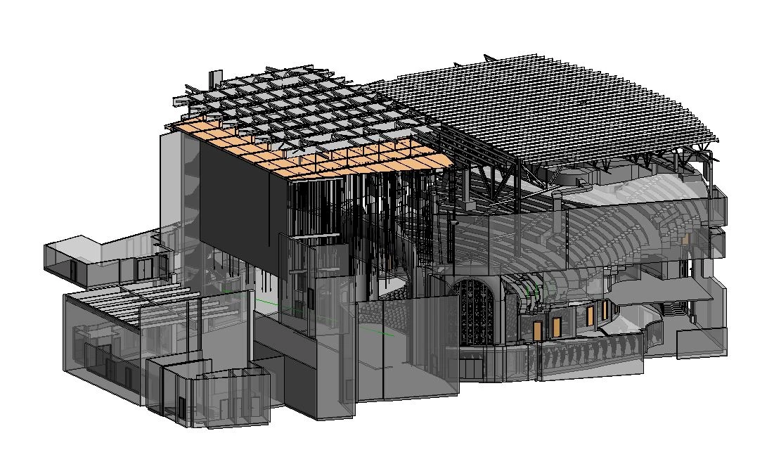
3D Laser Scanning The Detroit Opera House, Detroit, Michigan.
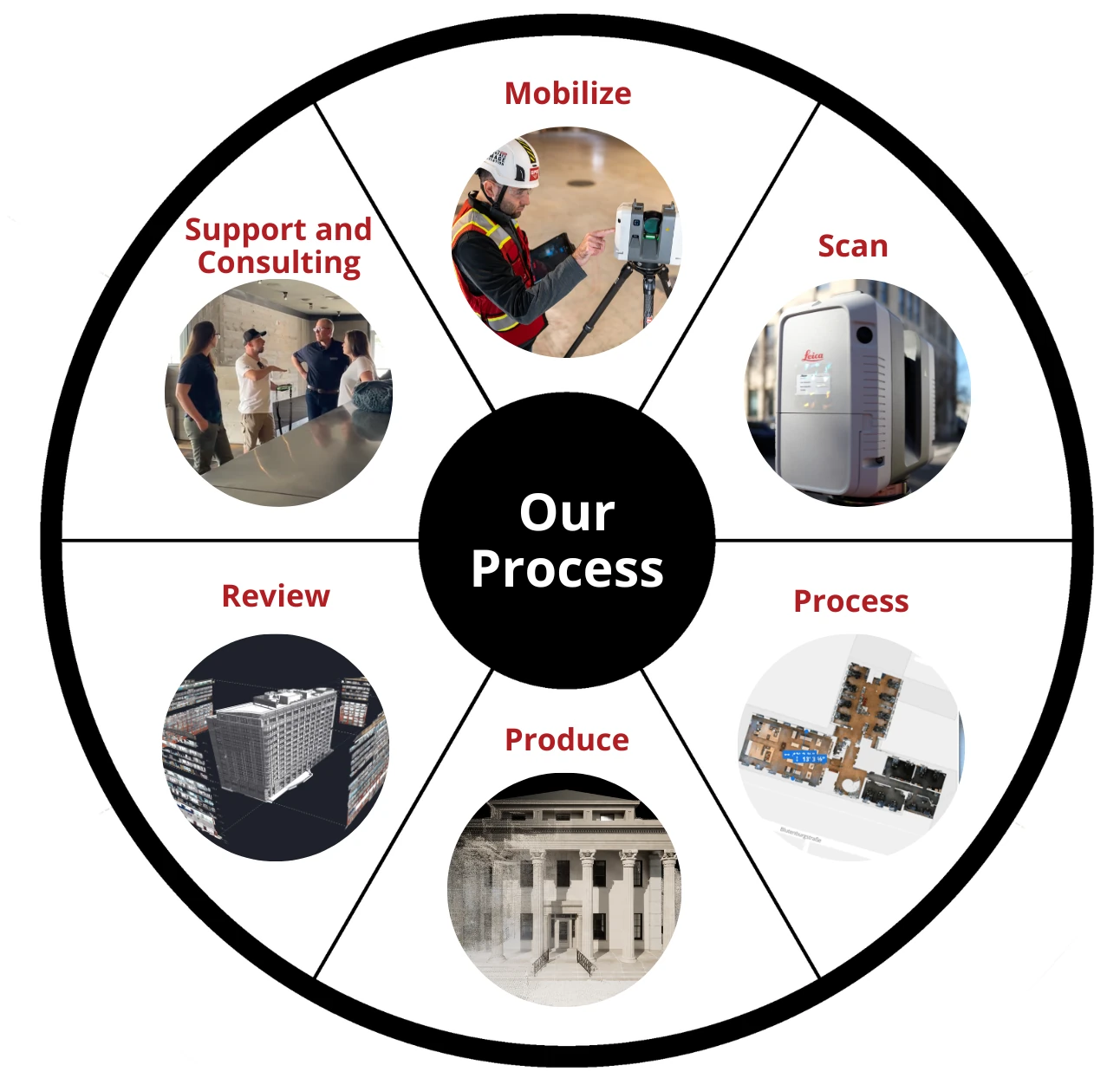
Our 3D Laser Scanning Process
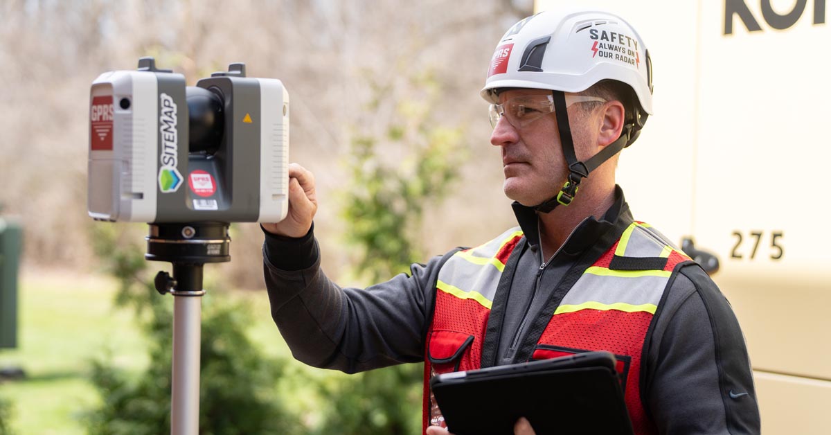
- Step 1: Mobilize: With nationwide service and fast mobilization, we partner with you to define the project scope, timeline, site conditions, equipment, and technical requirements to ensure the right 3D laser scanning solution for your project.
- Step 2: Scan: Using construction-grade 3D laser scanners, we quickly and accurately capture your building or site, including architectural, structural, and MEP layouts.
- Step 3: Process: We clean, align, and register 3D laser scan data into a unified point cloud, creating a reliable foundation for models and drawings.
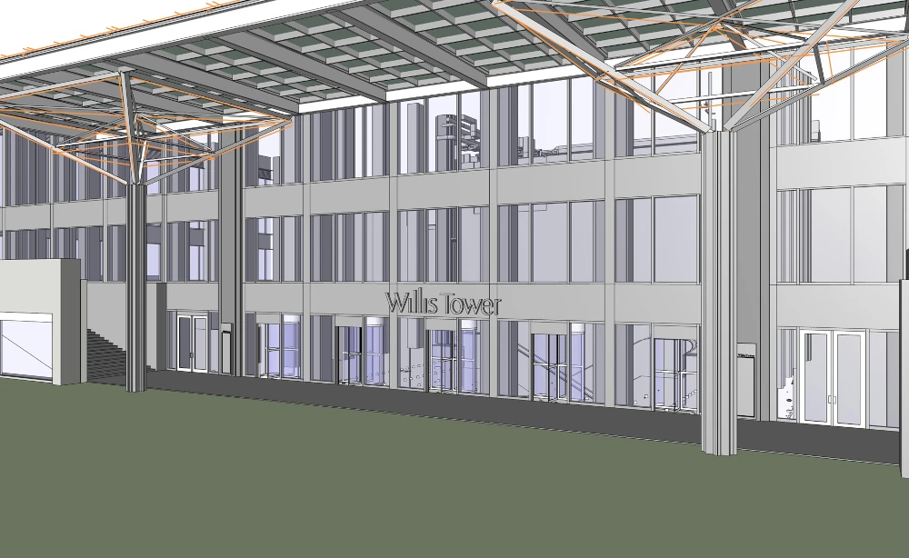
- Step 4: Produce: Based on your specifications, we convert scan data into custom deliverables, including 3D BIM models, 2D CAD drawings, and floor plans in your preferred format, such as Revit, AutoCAD, and Navisworks, ready for immediate use.
- Step 5: Review: Every deliverable is quality-checked for accuracy and prepared for seamless integration into your workflow. Your final approval ensures everything meets your expectations.
- Step 6: Support and Consulting: You receive expert guidance and priority support to maximize the value of your as-built data, keeping your project on time, on budget, and safe.
3D Laser Scanning
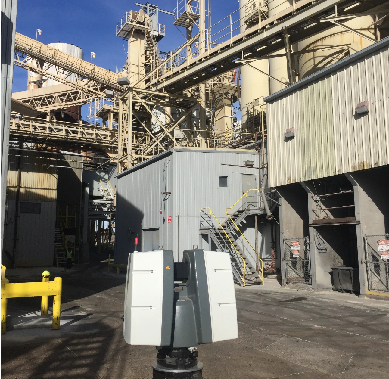
We use construction-grade LiDAR scanners to capture precise architectural, structural, and MEP layouts, delivering real-time, field-verified as-built documentation. Existing Conditions 3D Laser Scanning Services provide critical data that reduces design conflicts, improves collaboration, and streamlines workflows.
Learn More
As-Built Drawings
Receive detailed 2D CAD drawings to support construction planning and building modifications. From floor plans, sections, and elevations to RCPs and site plans, as-built drawings provides access to critical dimensions for informed decision making.
Learn More
3D BIM Modeling
We convert point cloud data into intelligent 3D BIM models that enhance collaboration, enable early clash detection, and support informed decision-making throughout the project lifecycle.
Learn More
MEP Documentation
We support seamless MEP installations with field-verified scans and detailed documentation. Our data-driven approach enables confident design and precise installation, eliminating guesswork and reducing costly surprises.
Learn More
Reality Capture
Using LiDAR-based scanning, we create high-resolution digital twins of existing buildings and sites. Reality capture data integrates into your preferred BIM software for visualization, analysis, and coordination.
Learn More
SiteMap
SiteMap® is a secure, cloud-based platform that centrally stores jobsite records for easy access and collaboration. Included at no extra cost with any Existing Conditions service, SiteMap provides remote access to CAD drawings and 3D models, empowering your team to make informed decisions, reduce risk, and streamline project planning.
Learn More
“We have been using Existing Conditions’ [reality capture] services for over a decade now.”
Tami Hughes
Senior Associate, DBVW Architects
.svg)
"Existing Conditions was fantastic to work with, and the client and site personnel were extremely interested in what the team were doing."
Kevin Kelly
Associate Partner, Robert A.M. Stern Architects
"The model looks fantastic! Our folks here in Facilities & the team up in Space Planning are all going to be very happy. Thank you so much!"
Lynn Berkley
Director of Facilities Management, Boston College
Related Case Studies


3D Laser Scanning Services Near Me
Available 24/7. Contact Us Today.
Available 24/7. Contact Us Today.


