The Uses of Laser Scanning within Real Estate and Beyond

Laser scanning and building information modeling turn the physical into the digital. They provide you with incredibly powerful tools and data with benefits that extend to nearly every industry. As you might have guessed, the uses of laser scanning can be particularly useful in the real estate industry.
Laser Scanning for Real Estate
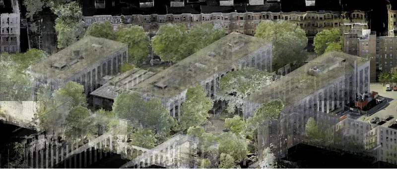
Laser scanning enables professionals to turn real estate into a digital asset that’s rich in information while also being highly accessible. They can view a property and its assets remotely, minimizing the need for multiple site visits.
Laser scanning provides the most precise and accurate physical measurements for real estate professionals, so you and your clients can plan for the exact space that’s available. With just a single 3D laser scan, real estate professionals can receive 3D walk-throughs, print quality photos, schematic floor plans, videos, and other media.
For multi-family residential properties, laser scanning can boost asset value by harnessing data about your property, maximize NOI, identifying opportunities, and performing intelligent needs assessments.
Laser Scanning for Construction
There are also invaluable uses for laser scanning in the construction industry. Using the precise and accurate data from 3D laser scanning, projects run smoother, safer, and more efficiently. Costs can be reduced thanks to fewer interruptions, errors and omissions, and manual measurements.
Laser Scanning for Architecture
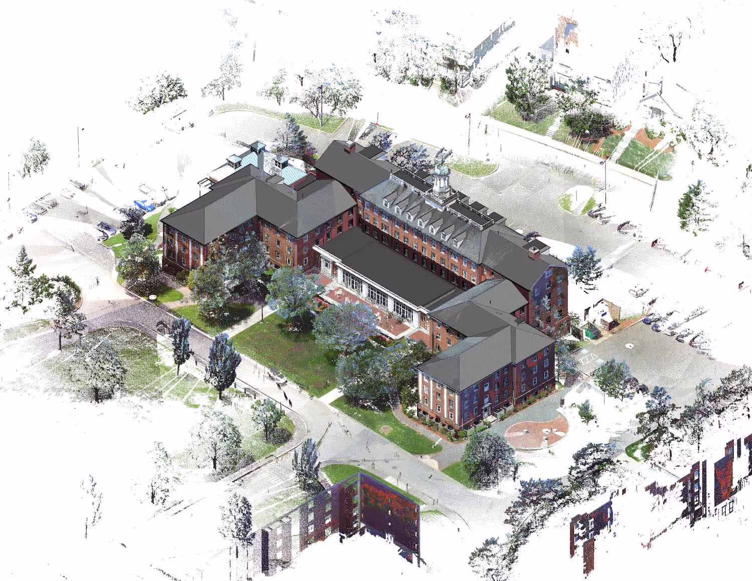
The architectural industry also reaps significant benefits from 3D laser scanning. When an architect can begin a project with the most accurate and up-to-date information possible, they’re able to eliminate headaches later on. Some of the tangible uses for the data you get from laser scanning include 3D flythroughs, globally georeferenced site plans, and other detailed renderings.
These are just a few of the extensive uses of laser scanning within real estate and beyond. If you’d like to learn more about what laser scanning can do for you and your business, contact Existing Conditions today. Our business was founded in 1997 to deliver high quality documentation more accurately, efficiently, and cost effectively than anyone else in the market. More than two decades later, we have measured and documented an estimated 10,000 buildings spanning over 700 million square feet of space for architects, engineers, building owners, and real estate professionals.
Existing Conditions 3D Laser Scanning Services
Our business was founded in 1997 to deliver high quality documentation more accurately, efficiently, and cost effectively than anyone else in the market. More than two decades later, we have measured and documented an estimated 10,000 buildings spanning over 700 million square feet of space for architects, engineers, building owners, and real estate professionals. Our dedicated Project Managers provide fast and accurate 3D laser scanning services and drone imagery services, and expert CAD and BIM technicians create custom, detailed deliverables, including point clouds, 2D CAD drawings, 3D BIM models, 3D mesh models, TruViews, and 3D virtual tours. Our greatest reward remains delivering superior-quality scan-to-BIM work and knowing we played a vital role in our clients’ projects.
FAQs
How Does Laser Scanning Work?
.svg)
One primary method is that a laser scanner sends light pulses at high speeds which reflect off objects and return to the scanners’ sensor. For each pulse, the distance between the scanner and object is measured by determining the elapsed time between the sent and received pulses. Each point of the scan will be converted to a pixel with a known x-, y-, and z- coordinate. Laser scans or LiDAR scans are taken in multiple positions around a site from varying viewpoints. Millions of data points are captured and processed into a point cloud, creating an accurate data set of the structure or site.
What are the Benefits of 3D Laser Scanning?
3D laser scanning captures millions of 3D data points per second for each scan location, providing incredibly rich data of a building or project site. Sites are captured in high detail the first time, eliminating disruption and the need for return visits. Datasets are dimensionally accurate, measurable and shareable, expediting project planning and execution. Accurate design plans are produced from the start expediting field work and reducing change orders, delays and costs. Communication is improved, teams can discuss plans while each has access to the same information, creating a more dynamic working environment.
What is a Digital Twin?
A digital twin is highly complex 3D virtual model of a physical building or infrastructure project that is the exact counterpart (or twin). Existing Conditions uses 3D laser scanners to collect real-time data in the form of point cloud and create a digital twin. Data can be easily visualized, measured, and analyzed. Digital twins can be used to improve efficiencies, optimize workflows and detect problems before they occur.