Frequently Asked Questions On 3D Laser Scanning


Reality capture has become a cornerstone technology in the fields of construction, architecture, and engineering. It helps document precise existing conditions. This improves accuracy, reduces risk, and streamlines workflows throughout the project lifecycle.
At Existing Conditions, a GPRS company, we often get questions about:
- 3D laser scanning
- LiDAR
- Building information modeling (BIM)
- Digital twins
And more. This guide answers common questions. It helps you understand these tools, deliverables, and their uses.
What is LiDAR?
LiDAR (Light Detection and Ranging) is a remote sensing technology that creates accurate 3D models of objects and surfaces. Unlike radar, which uses radio waves, LiDAR emits laser pulses from a scanner. These pulses reflect off surfaces, and the system measures the time it takes for the return to calculate the distance. This process produces highly detailed spatial data. It forms the foundation for 3D modeling and analysis.
What is the Difference Between LiDAR (Time-of-Flight) vs. Phase-Based Scanning
LiDAR systems typically use the time-of-flight principle. This method calculates distance by measuring the time a laser pulse takes to return:
Distance = (Speed of Light × Time of Flight) / 2.
Time-of-flight LiDAR is ideal for long-range measurements and large-scale projects. Yet, it generally collects data at a slower rate compared to phase-based scanning.
Phase-based scanners gather data faster. But they have a shorter range and pick up more noise. The phase shift between emitted and reflected signals determines the distances:
Distance = Phase Shift / (2π × Modulation Frequency).
Phase-based scanners capture data more quickly but have a shorter range and are more susceptible to noise. They are best suited for projects requiring rapid data acquisition in smaller areas.
What is 3D Laser Scanning?
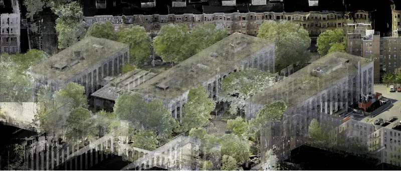
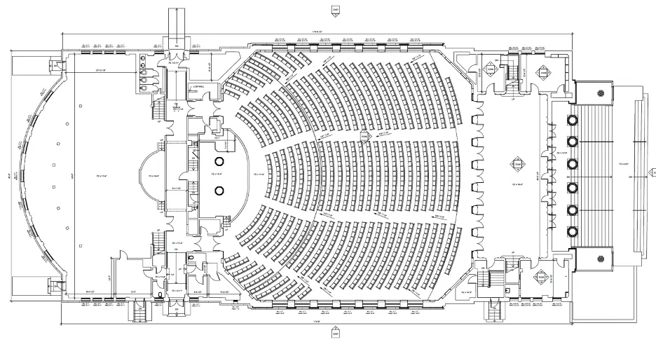
3D laser scanning uses LiDAR to capture precise distances and locations. The result is a point cloud. It’s a dense group of millions of points that show surfaces and structures. This data enables accurate documentation of existing buildings to support:
- Design and engineering: Ensures accurate base models for planning.
- Construction: Facilitates clash detection and quality control
Prefabrication: Provides exact dimensions for off-site fabrication.
Facility management: Maintains accurate records for maintenance and renovations.
What is Reality Capture, Exactly?
Reality capture refers to the process of using technology to make digital records of real-world spaces. Some of these technologies include 3D laser scanning and photogrammetry. These methods create accurate datasets. You can turn these into models, maps, and visualizations to use throughout the project lifecycle.
.jpg)
How Does Existing Conditions Conduct Reality Capture Services?
Existing Conditions, a GPRS company, captures millions of accurate data points on-site to document existing conditions in detail. These datasets are processed into point clouds. They are then converted into 2D CAD drawings or 3D BIM models, based on client needs. This approach ensures precise planning and seamless coordination across all project disciplines. It reduces costly rework and improves overall efficiency.
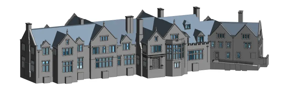
What is a BIM or a 3D BIM Model?
Building Information Modeling (BIM) is a digital representation of a facility’s physical and functional characteristics. A 3D BIM model includes geometry, spatial relationships, and embedded data. BIM enhances collaboration, visualization, and decision-making during design, construction, and facility operations.
What is a Digital Twin?
A digital twin is a dynamic, data-rich virtual model that mirrors a physical asset. Existing Conditions uses 3D laser scanning to capture real-time data for creating digital twins. These models allow users to:
- Visualize and measure conditions remotely
- Analyze performance and detect issues before they occur
- Optimize workflows and improve operational efficiency
Are Reality Capture and Digital Twin the Same Thing?
Reality capture and digital twins are related but distinct concepts. Reality capture focuses on collecting accurate spatial data from the physical world. A digital twin builds on this foundation. It integrates real-time data and analytics to create a model that is interactive and undergoes constant updates. Existing Conditions provides both solutions, tailored to your project needs.
What is As-Built Documentation?
As-built documentation includes precise drawings that show the project's final built state. These records show all changes made during construction.
Have more questions? Dive into the comprehensive article for even more answers.
Over the past 27 years, Existing Conditions has measured, documented, and modeled over 10,000 buildings spanning over 700 million square feet across the United States, establishing ourselves as an industry leader in reality capture. Architects, builders, engineers, developers, and facility managers trust us to deliver digital representations of the as-built environment with unparalleled accuracy and efficiency. Our services, including 3D laser scanning, 3D photogrammetry, and BIM modeling, Visualize The Built World® to enable architects to make informed design decisions based on the most accurate data available.
What can we help you visualize?