Advanced Engineering Applications with 3D Laser Scanning

.webp)
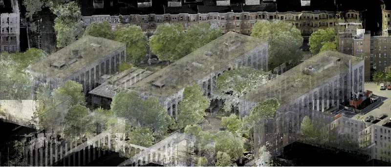
Precision Data Capture for Accurate Site Documentation
3D laser scanning is a high-precision method used by our Project Managers to document existing conditions with exceptional accuracy. This technology captures millions of data points in seconds, forming a dense point cloud that represents the scanned environment in three dimensions. These point clouds are used to create detailed 2D as-built drawings and 3D Revit models that support engineering analysis, design validation, and construction planning.
Unlike traditional measurement methods, 3D laser scanning reduces human error and eliminates the need for repeated site visits. Engineers can extract exact measurements from the scan data, ensuring that all dimensions are highly accurate and consistent. This is especially important in projects where tolerances are tight, and rework is costly.
3D Laser Scanning in Complex Environments
Many engineering projects involve 3D laser scanning in areas that are difficult to access or operate in. These include:
• Mechanical Rooms: Packed with piping, ductwork, and equipment, these spaces require careful 3D laser scanning to avoid blind spots.
• Hospitals and Labs: Active environments where field work must be done without disrupting operations.
• Elevator Shafts and Interstitial Spaces: Vertical and confined areas that require specialized 3D laser scanning setups.
To address these challenges, Existing Conditions uses tripod-mounted LiDAR laser scanners from Leica Geosystems. These scanners can capture data from a distance, reducing the need for physical access and improving safety.
In addition to industrial and commercial sites, Existing Conditions has also scanned cultural and historical assets. For example, statues and monuments can be scanned to create mesh models for preservation, replication, or structural analysis. These models are often delivered in STL or OBJ formats, which are compatible with 3D printing and simulation tools.

Key Engineering Use Cases
Engineers use 3D laser scanning to support a wide range of technical applications. These include:
• Comparative Analysis
• Deviation and Deformation Analysis
• Floor Flatness and Levelness Analysis
• Prefabrication Support
• New Construction Verification
• 2D Drawings and 3D Design Models Reconciliation
• Structural Steel Shape Probability Analysis
• Volume Calculations
• Wall Plumb Analysis
• Tank Analysis
• Forensic Analysis
Engineering Software and File Format Capabilities
Our team uses trusted engineering software to create accurate as-builts and 3D BIM models from laser scan data. We work in platforms like Autodesk and MicroStation, along with other specialized software, to meet the needs of engineers across many disciplines. This allows us to deliver files in a wide range of formats, ready for use in your workflows.

Supported File Formats
We provide files in formats that work with engineering and design software. Below is a breakdown of the types of files we deliver:
Point Cloud Formats: .lfm, .pts, .e57, .rcs, .las, .lgs, .ptg
2D CAD Drawing Formats: .rvt, .dwg, .dgn, .pdf
3D Mesh Formats .stl, .ply, .fbx, .obj
3D Model Formats: .dwg, .stp, .rvt, .ifc
Engineering Collaboration and Workflow Integration
At Existing Conditions, we partner with our clients to solve complex engineering challenges. Our team builds strong partnerships by focusing on clear communication during each project.
“I am 100% confident that we can partner to solve any engineering or construction project,” says Nate Baker, Laser Scanning Service Line Leader. “We lead the industry with what we are able to do with point clouds and laser scanning. We aren’t looking to industry norms to dictate what we do. Our goal is to widen the gap between our work and the industry standard.”
Existing Conditions as a Technical Partner
We don’t just deliver as-built documentation – we help engineers find the right solution for their specific needs. Our team listens closely to understand the full scope of each project and then applies the right tools and workflows to meet those needs.
Existing Conditions uses advanced tools from trusted providers like Leica Geosystems and Autodesk. These technologies allow us to collect high-resolution point clouds and convert them into usable as-builts and 3D BIM models. Our deliverables integrate easily into your existing software, making it simple to move from scan to solution.
Our reality capture services help:
• Speed up fieldwork
• Improve productivity
• Reduce change orders
• Lower project costs

3D Laser Scanning Advanced Analysis Examples
ACM Panel Prefabrication at LaGuardia Airport
At LaGuardia Airport, a client was preparing to install aluminum composite material (ACM) panels on the canopy of a newly built terminal. The panels had to be lifted and placed 80 feet in the air using an overhead system. However, the construction drawings did not match the existing conditions, creating a risk of misalignment and costly rework.
To solve this, Existing Conditions performed a 3D laser scan of the canopy and curtain wall façade using the Leica ScanStation P50. This cutting-edge scanner captured detailed as-built data of the structure. The scan produced a dense point cloud that was used to generate both 2D CAD drawings and a 3D BIM model of the canopy.
These deliverables gave the engineering team the exact dimensions and geometry needed to prefabricate the ACM panels off-site.

Concrete Formwork Verification for Wind Turbine Deck
In this project, Existing Conditions used 3D laser scanning to verify the shape and placement of concrete formwork for a wind turbine deck. The formwork had a complex geometry, and it was critical that it matched the design specifications before concrete was poured.
The first 3D laser scan captured the as-built condition of the formwork. Using this data, Existing Conditions created 2D drawings and performed a detailed comparison against the design documents. The analysis showed that several areas of the formwork needed adjustment to meet the required tolerances.
After the client made the necessary modifications, Existing Conditions returned to the site to perform a second 3D laser scan. This updated point cloud confirmed that the changes brought the formwork into alignment with the design.

Power Stack Bracket Alignment and Thermal Growth Analysis
One of Georgia’s largest power supply cooperatives needed to verify the alignment of brackets on a power stack before installing baffles. The client also wanted to determine whether the guide supports needed to be moved to allow for thermal expansion during operation.
To support this analysis, Existing Conditions used two 3D laser scanners – the Leica ScanStation P50 and the Leica RTC360 to capture the full geometry of the power stack. These scanners collected millions of data points, creating a detailed point cloud of the structure.
.webp)
Verifying Structural Steel for Large-Scale Stadium Signage
During the construction of a new sports stadium, a client needed to install large-scale exterior signage. To ensure proper placement, it was critical to verify the centerlines of the structural steel framework where the signage would be mounted.
Existing Conditions was selected to perform a 3D laser scan of the steel structure. The 3D laser scan captured accurate as-built data, allowing the engineering team to compare the actual steel layout to the original design plans.
After reviewing the point cloud data, the client quickly identified a major issue: the structural steel on the north and south ends of the stadium did not align with the design drawings. This misalignment could have caused installation problems and delays.
Thanks to the 3D point clouds, the client and the general contractor were able to take immediate action. They coordinated adjustments to the steel in those areas before the signage was installed.

3D Mesh Modeling of Studio Stage and LED Panel Layout
Existing Conditions 3D laser scanned a film studio’s stage and LED panels to create a detailed .obj mesh model for use in a virtual reality production environment. The model gave the client an accurate digital layout to align real-world elements with virtual scenes during filming.

Floor Flatness
A general contractor needed to verify floor flatness to ensure the surface could support materials handling equipment. Existing Conditions used 3D laser scanning to collect precise point cloud data, which was analyzed to calculate FF and FL values and deliver color elevation maps. These maps clearly showed high and low areas in the concrete, helping define where surface corrections were needed.

Read more about this project here.
Floor Surface Contours and Wall Elevation Analysis for Tank Structures
At a solar power facility in Arizona, Existing Conditions was asked to provide floor surface contours and a radial grid of spot elevations for newly constructed and refurbished tanks.
In addition to floor data, the client requested wall contour analysis. Existing Conditions’ Mapping & Modeling Team fit a perfect cylinder to the tank walls using point cloud data, then “split” the circular wall into a flat 2D plane to show variations between the actual wall and the ideal cylinder.

Our Pricing
The cost of 3D laser scanning depends on the size and complexity of your project, and Existing Conditions provides custom quotes based on your specific needs. Our Project Managers use advanced 3D laser scanners to capture detailed site data with high, including structural, architectural, and MEP features above ground, as well as utility and concrete markings below. Existing Conditions delivers a wide range of deliverables: point clouds, 2D CAD drawings, 3D BIM and mesh models, TruViews, and virtual tours – at any level of detail required.
For more information on Existing Conditions’ 3D laser scanning services, click here.
FAQs
What is a Point Cloud?
.svg)
A point cloud is a collection of data points in a 3D coordinate system, where each point represents a specific location on the surface of an object, essentially creating a digital 3D representation of that object; typically generated using a 3D laser scanner or 3D photogrammetry, with each point containing its own X, Y, and Z coordinate.
What are the Benefits of 3D Laser Scanning?
3D laser scanning captures millions of 3D data points per second for each scan location, providing incredibly rich data of a building or project site. Sites are captured in high detail the first time, eliminating disruption and the need for return visits. Datasets are dimensionally accurate, measurable and shareable, expediting project planning and execution. Accurate design plans are produced from the start expediting field work and reducing change orders, delays and costs. Communication is improved, teams can discuss plans while each has access to the same information, creating a more dynamic working environment.
Why Should Clients Choose Existing Conditions for their As-Built Drawings Service Needs?
Since 1997, architects, builders, engineers, developers, facility managers, and building industry professionals have trusted Existing Conditions for their as-built drawing service. We have an expert team equipped with state-of-the art technology and software required to deliver accurate and reliable data, drawings, and models tailored to each project scope. Our as-built drawing services provide precise documentation of your completed projects, ensuring accurate records for renovations and future planning and reduced error and costs with clear, updated layouts. Whether it’s for construction, renovations, or facility management, our as-built drawings deliver the clarity and accuracy you need to succeed.