How Reality Capture Could Have Helped Prevent the Sinking of Kansai International Airport


Kansai International Airport was hailed as an engineering marvel upon its completion 30 years ago. Now, the airport is facing an issue its designers did not anticipate occurring at its current pace: the airport and the artificial island that supports it are sinking into the ocean and could be at or below sea level in a few decades.
While some sinking was expected by designers from the beginning stages of construction, its current trajectory is raising some red flags.
To fully understand the impact of this problem, one must first know the history of the Kansai International Airport and how important it is to Japan.
The History and Importance of the Kansai International Airport
In the 1960s, the growing power of Tokyo was leaving regions like Kobe and Osaka behind, and they needed to make a big change. Government officials proposed the idea of building an airport. The original plan was to build the new airport near Kobe, but when Kobe rejected the offer, developers set their sites on Southern Osaka, specifically Osaka Bay.
Along with the need to catch up to Tokyo, this new airport was built to support Osaka’s current airport, Itami Airport, that was located in densely populated suburbs and was experiencing overcrowding.
Developers also wanted to avoid protests from residents and landowners who lived near the proposed airport, as that was an issue at the time in Tokyo. So, they decided to build an artificial island in Osaka Bay to house this new airport. However, they still would not break ground for another 20 years, because of an extensive approval process, the potential for extreme weather, and tedious planning methods.
In 1987, crews began reclaiming land from the sea and transforming it into what would become the foundation of the artificial island.
Four years later, the 4 kilometer (2.5 mi.) long and 2.5 kilometer (1.6 mi.) wide island was completed. Shortly after, the construction of the airport began. It would open its doors three years later, in 1994.
The Kansai International Airport’s impact on Japan’s aviation landscape was undeniable. All international arrivals to Osaka were immediately shouldered by Kansai. They reached their peak in 2019 with 29.4 million recorded passengers. After struggling through the pandemic, it has since recovered and was named the world’s best airport for luggage handling in 2024.
By learning from the knowledge and experience gained during the construction of Kansai International Airport, other airports like the Hong Kong International Airport, Centrair (Nagoya), and Kobe Airport were also constructed on artificial islands.
Whenever someone is the first to do something revolutionary, they carve the path that others follow, but they are also the first to face unique problems that they can then help others avoid. The problem the Kansai International Airport has faced since the beginning is that it is gradually sinking into the ocean.
Why is it Sinking?
.webp)
The Kansai International Airport has been sinking into the ocean much faster than anticipated.
Upon its completion over 30 years ago, engineers had originally estimated the airport would sink by roughly 13 feet over the next 50 years. Since 1987, when the construction of the island began, it has sunk by more than 40 feet.
The main reason reported for the acceleration is the makeup of the island’s foundation. Soft alluvial clay was compressed under the weight of the artificial island to create its foundation.
Despite engineers installing sand drains and reinforcements to manage the sinking, they could not stop the land from settling, which began before the airport’s first day of operation in 1994.
Some experts are also accrediting the sinking airport to climate change and extreme weather conditions.
A byproduct of climate change can be the rising of sea levels. The National Oceanic and Atmospheric Administration, or NOAA, reports that sea levels are rising at an accelerated rate due to the melting of glaciers and ice sheets. Rising sea levels paired with a sinking infrastructure could have contributed to the Kansai International Airport sinking faster and sooner than originally calculated.
Then, in 2018, Japan was struck by Typhoon Jebi. The deadly typhoon led to flooding at the airport and left thousands of passengers stranded when the bridge to the mainland was damaged and all flights were cancelled.
In response to the effects of the storm, engineers raised the seawall by 2.7 meters (8.86 ft). They also invested £112 million, or around $149 million, in the installation of hydraulic jacks with iron plates that can raise the foundation in stages. It serves as a short-term solution as the jacks will need to be adjusted every couple of years, and each year will prove more costly and complex than the last.
Despite these countermeasures, the sinking unfortunately has not been impeded, and current estimates claim some portions of the airport will fall below sea level by 2056.
Without the Kansai International Airport and the millions of passengers it serves annually, the economy of the Osaka region and Japan may sink with it.
Decades after the completion of this ambitious project, engineers can admit that Mother Nature had a larger impact than expected. But what could they have done differently?
How Reality Capture Could Have Helped
Reality capture and 3D laser scanning technology could have been a huge help during the construction of Kansai International Airport.
3D laser scanning technology was created in the 1960s, but wasn’t utilized for design and engineering purposes until the 1990s, coincidentally following the timeline from concept to creation of Kansai.
The main benefit to the project would have been consecutive reality capture scans of the airport, especially during the raising of the seawall and reinforcements following the typhoon. 3D laser scans and the subsequent 3D point cloud data collected would allow engineers to create a 3D BIM model of the airport and its infrastructure.
3D BIM models provide architects, engineers, contractors, and developers an accurate digital twin of buildings and infrastructure to collaborate on design, construction, and operations. BIM models also help minimize miscommunication, errors, and rework to ensure projects are completed on time and within budget.
By creating a 3D BIM Model, architects and engineers for the airport would have been able to make quicker decisions to remedy the problems and would have been shown exactly where the island’s foundation was collapsing and at what rate.
For all 3D laser and reality capture projects, it is important to hire professionals like Existing Conditions, a GPRS company.
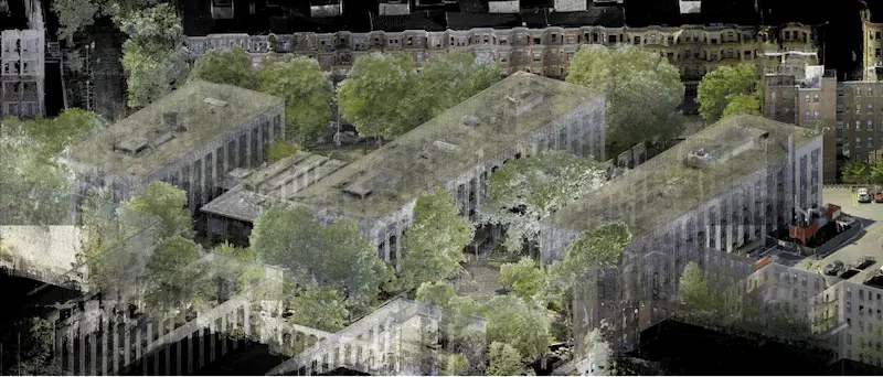
Over the past 27 years, Existing Conditions has measured, documented, and modeled over 10,000 buildings spanning over 700 million square feet across the United States, establishing ourselves as an industry leader in 3D laser scanning. Architects, builders, engineers, developers, facility managers, trust us to deliver digital representations of the as-built environment with unparalleled accuracy and efficiency. Our services, including 3D laser scanning and BIM modeling, Intelligently Visualize The Built World® to enable architects to make informed design decisions based on the most accurate data available.
What can we help you visualize?
FAQs
What is 3D Laser Scanning?
.svg)
3D laser scanning captures the as-built documentation of existing buildings or sites. Data is acquired with a 3D laser scanner equipped with LiDAR technology in the form of a point cloud and is used to develop 2D CAD drawings or 3D BIM models, expediting the design, planning, and development of architecture, engineering, and construction projects.
Why is a Point Cloud Important?
Point clouds provide powerful and dynamic information for a project. By representing spatial data as a collection of coordinates, point clouds deliver large datasets that can be mined for information. The visualization and analysis from this data is invaluable for decision making. Our Product team transforms point clouds into customized drawings and models used for visualization, analysis, design, construction, renovation, prefabrication, and facility modifications.
What is a 3D BIM Model?
A building information model (BIM) is a digital representation of the physical and functional characteristics of a building or infrastructure project. BIM stores all the information about a building's life cycle in one place, including design, construction, and operational data, which can be used for planning, renovation, and maintenance. It provides accurate spatial relationships and manufacturer details, as well as geographic information and other pertinent aspects of the building.