What to Expect from 3D Laser Scanning in a Day


No matter how big or small your building or structure is, you need accurate, high-quality as-built data to plan, design, and build better.
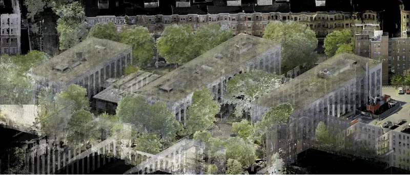
3D laser scanning creates a detailed digital model of your site with construction-grade accuracy.
The amount of space that can be 3D laser scanned in one day depends on several factors. These factors include the complexity of the site, the type of 3D laser scanners used, the Project Manager's experience, and the level of detail required for the scan.
What Impacts the Time Needed to 3D Laser Scan a Site
The total square footage, number of rooms, building layout, occupancy status, and the required level of detail are all factors that affect the amount of space that can be 3D laser scanned in one day.
For instance, Existing Conditions can scan a small mechanical room or an empty commercial building in a single day. Larger sites, like manufacturing plants, may take several days – especially if equipment is tightly packed.
“Depending on the scope of the project, we can complete a 10,000 square foot office or a 200,000 square foot warehouse in a day,” said Existing Conditions 3D Laser Scanning Service Line Leader, Nate Baker. “Often, we can determine the project scope with a short virtual meeting, or we can schedule a complete site walk to ensure our quote is 100% aligned with your requirements.”
For complex buildings that include multi-floor or multi-rooms, 3D laser scanning can be sped up using the Leica RTC360, a compact and mobile 3D laser scanner. In dense mechanical, electrical, and plumbing (MEP) rooms, the Leica P50 ScanStation is used to capture detailed 3D laser scans of equipment and piping.
Sites that are in use, like active factories or occupied offices, may require 3D laser scanning during off-hours, such as evenings or weekends.
Because every site is different, Existing Conditions works directly with clients to define the project scope and 3D laser scanning needs. This ensures each quote and timeline is tailored to the specific project.
RELATED ARTICLE: 3D Laser Scanning Project Delivery Schedule
Choosing the Right 3D Laser Scanner for the Job
The type of 3D laser scanner used on a project directly affects how long the scanning process will take. Different 3D laser scanners offer varying speeds, ranges, and levels of accuracy.
The Leica P-Series scanners, for example, can collect up to 1 million points per second in under 2 minutes. They have a range of over 1 kilometer and have high accuracy. The NavVis VLX is a mobile scanner that uses SLAM (Simultaneous Localization and Mapping) to quickly and accurately scan complex spaces. It features dual LiDAR sensors, 360° imaging, high-resolution cameras, and a touchscreen interface, which makes it ideal for large or active environments. The Matterport Pro3, now equipped with LiDAR, captures 100,000 points per second in less than 20 seconds per scan. It offers 20 mm accuracy within a ten-meter range and can scan up to 100 meters.
Existing Conditions’ Project Managers are trained to evaluate each site and choose the best scanner to meet the project’s goals.
To begin scanning, the scanner is mounted on a tripod, leveled, and configured to match the project’s needs. Control points are marked, and a site plan is created. Scanners are then placed at strategic locations to capture the site from multiple angles. The scanner’s range and resolution determine how far apart these positions can be.
After scanning, the data must be processed and aligned to provide high accuracy. Some scanners can pre-register scans in the field, which speeds up this step.
Existing Conditions’ Project Managers complete a rigorous training program to ensure they are skilled in using scanning equipment and interpreting field data. They use a variety of scanners, including the Leica P-Series ScanStations, Leica RTC360, Leica BLK360, NavVis VLX 2, and Matterport Pro3 – selecting from this array of tools based on the specific needs of your project.
.webp)
Leica P-Series ScanStation (P50/P40/P30)
- Long-range scanner with up to one-kilometer range reduce time spent on setup and repositioning
- Delivers high-accuracy point clouds (2-4 mm) and HDR images
- Captures data at a rate of 1 million points per second
- Produces survey-grade point clouds tied to a coordinate system for verified accuracy
- Equipped with a dual-axis compensator to maintain level scans and control movement
.webp)
Leica RTC360 Laser Scanner
- Mid-range scanner offering 2–6 mm accuracy
- Lightweight and portable (under 12 lbs) with acollapsible tripod
- One-button operation for fast, automatedscanning
- Captures 2 million points per second andcompletes scans in under 2 minutes
- Includes HDR imaging and colorized point clouds
- Visual Inertial System (VIS) registers scans inthe field to speed up processing
.webp)
Leica BLK360 Laser Scanner
- Designed for small-scale projects, thisultra-compact scanner weighs less than 2 pounds and fits easily in a backpack
- Offers a 60-meter range and delivers point cloudaccuracy between 4–7 mm, along with high-dynamic-range (HDR) spherical imagery
- Completes a full scan in approximately 20seconds, capturing data at a rate of 680,000 points per second
- Features a fully automated, single-buttoninterface for simple and efficient operation
- Equipped with a Visual Inertial System (VIS)that pre-registers scans in the field, reducing post-processing time
- Supports fast export of LGS and RCP file formatsfor seamless integration with Autodesk software
- Enables wireless streaming of point cloud dataand HDR images directly to an iPad or Cyclone Register 360 via Wi-Fi
.webp)
NavVis VLX 2
- 16-layer LiDAR sensors
- Mobile mapping system using SLAM for fast,accurate scanning
- Ideal for large or complex environments wherespeed and mobility are key
- Not suitable for all sites due to its size andoverhead design
- May be difficult to use in tight spaces orthrough standard doorways
- Requires open space to utilize SLAM capabilitiesfully
- Best used in conjunction with the Leica RTC360or P50
.webp)
Matterport Pro3
- Scans indoor and outdoor spaces to create full-color digital twins
- Uses LiDAR and a camera to capture 20mm accuracy within a 10m range
- Flexible scanning ranges from 0.5m to 100m
- Collects 100,000 points per second in under 20 seconds per scan
- Features a 30-megapixel sensor and 12-element lens for high-quality 6068 × 3413 JPG images
- Recommended scan spacing is no more than 8m in large, open areas
- E57 point cloud includes 10 points per degree both vertically and horizontally
Why Experienced Project Managers Matter in 3D Laser Scanning
Becoming skilled in 3D laser scanning takes time and training. Existing Conditions’ Project Managers complete a detailed training program that covers how to use scanning equipment and follow best practices. They learn more than just how to operate the scanners – they’re trained in efficient workflows, scan alignment, registration, data cleanup, target placement, and software use.
Existing Conditions’ Project Managers are trained to select the right scanner based on the accuracy needs of the client. Their expertise helps reduce labor hours and lower your overall project costs.
For larger or more complex projects, multiple Project Managers or several days on-site may be needed to complete the scan efficiently. Whether scanning a large academic campus or a chemical plant, Existing Conditions’ Project Managers are prepared to get the job done right the first time.
How LOD Impacts 3D Laser Scanning & BIM Modeling
In the architecture, engineering, and construction (AEC) industry, the term “Level of Detail” (LOD) describes how much information is included in a 3D Building Information Model (BIM). When 3D laser scanning a site, it’s important to define the required LOD early in the project. This helps determine the accuracy of the scan and the point cloud data.
The Existing Conditions Mapping & Modeling Team uses the LOD requirements to guide how both graphical and non-graphical elements are built into the BIM model. These details ensure the model meets the specific needs of your project.
To get an accurate quote and timeline, consult with your Existing Conditions Account Executive and Project Manager to define the LOD needed. With clear LOD specifications, the Mapping & Modeling Team can deliver precise BIM models faster.
RELATED ARTICLE: Explaining the Difference Between Level of Detail and Level of Development in BIM Modeling
How Long Does a 3D Laser Scan Take?
Here’s a general breakdown of the time it takes to complete a single scan using the Leica P50 ScanStation:
- Project setup: ~5 minutes
- Scan and camera rotation: ~2 minutes
- Move to next scan location: ~2 minutes
To estimate the total scanning time, multiply this cycle by the number of scan positions needed to cover the site. Our 3D laser scanning company can evaluate your site and provide a reliable estimate based on its size and complexity.
As each scan is completed, a simplified version of the point cloud and images are instantly available on a tablet or mobile device. The Project Manager can then add notes, tags, photos, and even voice memos directly to the scan, ensuring that no field details are missed or forgotten.
After the documentation is complete, the full-resolution point cloud, images, and field notes are sent to the Existing Conditions Mapping & Modeling Team. They process and register the data to create the final deliverables.
Depending on your needs, Existing Conditions can provide raw point cloud files or custom outputs like 2D CAD drawings, 3D meshes, BIM models, or virtual walkthroughs. Deliverables are shared via Google Drive or ACC (Autodesk Construction Cloud).
.webp)
.webp)
What Are Common Applications of 3D Laser Scanning?
3D laser scanning can be used in an infinite number of ways. Here are some of the most common uses:
- As-built survey, reality capture, or existing conditions survey
- Checking construction progress and planning next steps
- Design engineering for expansions or facility upgrades
- 2D and 3D maps of buildings
- Helping with prefabrication
- Clash detection
- Historic preservation or architectural documentation
- Measuring volumes, overhead clearances, and deformations
- Virtual design and construction
- Geospatial data collection
- Creating a digital twin
- Analyzing and visualizing data
The purpose of your project will decide the type of scan needed, how detailed the point cloud and photos must be, and what kinds of maps, models, or drawings are required.
Why Partner with Existing Conditions?
For over two decades, Existing Conditions has provided accurate building documentation for the best architects, engineers, and general contractors across the country.
We are a 3D laser scanning company with Project Managers in every major U.S. market, each equipped with advanced 3D laser scanning tools to capture accurate site data quickly and efficiently.
Our Project Managers complete a rigorous training program that covers 3D laser scanning equipment, field techniques, and data accuracy. They are prepared to handle a wide range of environments and deliver the best results. Our Mapping & Modeling Team also continues to expand their knowledge to improve workflows and speed up the delivery of high-quality as-built drawings and BIM models.
Ongoing professional development across our team ensures we maintain the highest standards of service and accuracy.
We’re your scan-to-BIM team. Outsmart the unknown by having the best situational awareness of your most valuable assets, and contact us to get started today.
FAQs
How Does Laser Scanning Work?
.svg)
One primary method is that a laser scanner sends light pulses at high speeds which reflect off objects and return to the scanners’ sensor. For each pulse, the distance between the scanner and object is measured by determining the elapsed time between the sent and received pulses. Each point of the scan will be converted to a pixel with a known x-, y-, and z- coordinate. Laser scans or LiDAR scans are taken in multiple positions around a site from varying viewpoints. Millions of data points are captured and processed into a point cloud, creating an accurate data set of the structure or site.
What are the Benefits of 3D Laser Scanning?
3D laser scanning captures millions of 3D data points per second for each scan location, providing incredibly rich data of a building or project site. Sites are captured in high detail the first time, eliminating disruption and the need for return visits. Datasets are dimensionally accurate, measurable and shareable, expediting project planning and execution. Accurate design plans are produced from the start expediting field work and reducing change orders, delays and costs. Communication is improved, teams can discuss plans while each has access to the same information, creating a more dynamic working environment.
What is LiDAR?
LiDAR, which stands for Light Detection and Ranging, is a remote sensing method used to generate precise, three-dimensional information about the shape of an object and its surface characteristics. 3D laser scanners utilize LiDAR technology to precisely capture the three-dimensional data of a structure or site. LiDAR operates by emitting light as a pulsed laser to measure distances to a target. When these laser pulses bounce back to the scanner, the distances are recorded, mapping the spatial geometry of the area. This process collects millions of measurement points, each with x, y, and z coordinates, forming what is known as a point cloud.