At-Depth Modeling: What Is It and How It Can Elevate Your Next Project?


Existing Conditions is now a GPRS company. GPRS is known for our industry-leading underground utility, concrete, and reality capture scans. You may also be aware of our video pipe inspection (VPI) services where our NASSCO-certified Project Managers non-destructively assess the conditions of sanitary and storm sewer lines.
When utilizing at-depth modeling, the GPRS team combines these services into one comprehensive, detailed digital model of your site.
What Is At-Depth Modeling?
At-depth models are a type of Revit model, which is a building information modeling (BIM) software used to create, edit, and review 3D models of buildings and infrastructure in exceptional detail.
With the addition of data collected by Project Managers in the field, at-depth models accurately insert the subsurface utilities and concrete obstructions, like post tension cables, conduit, and rebar, below the surface of the model.
How Is an At-Depth Model Created?
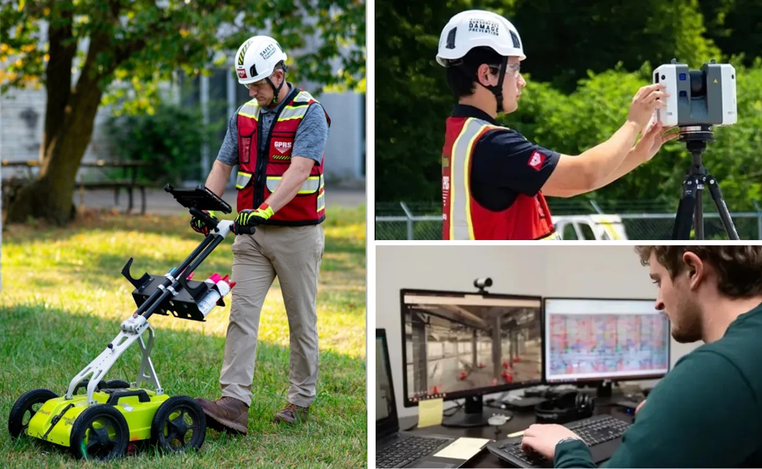
At-depth modeling is done by performing utility locating scans, concrete scans, video pipe inspections, and reality capture scans of a site. Typically, the utility and concrete scans are performed first. GPRS Project Managers conduct these scans using electromagnetic (EM) locators and ground penetrating radar (GPR). Our SIM-certified Project Managers utilize these complementary technologies to maintain our industry-leading 99.8% accurate underground utility and concrete scans.
Sewer inspections would be performed next. VPI reports, like NASSCO-compliant WinCan reports, provide the Mapping & Modeling Team with the size of the pipes that can be represented on the model and provide the client with a better visual of the underground sewer lines. While the same can’t be done to that extent with other utilities, they are always represented using the industry standard color code and with linework that emulates CAD drawings.
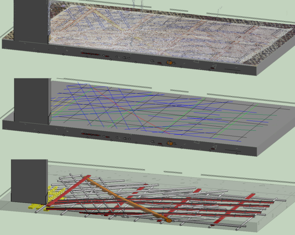
Once the subsurface data is collected, our Reality Capture Project Managers document the site with LiDAR-based 3D laser scanners. These scanners document sites with 2-4 mm accuracy.
Performing the reality capture scans after the utility and concrete scans can streamline the process, because of the markings placed on the surface by Project Managers in the field. By capturing those markings with millimeter-accuracy, the Mapping & Modeling Team will already have the location of the utilities and obstructions mapped out within the scans. This eliminates the possibility of missing data within the at-depth model.
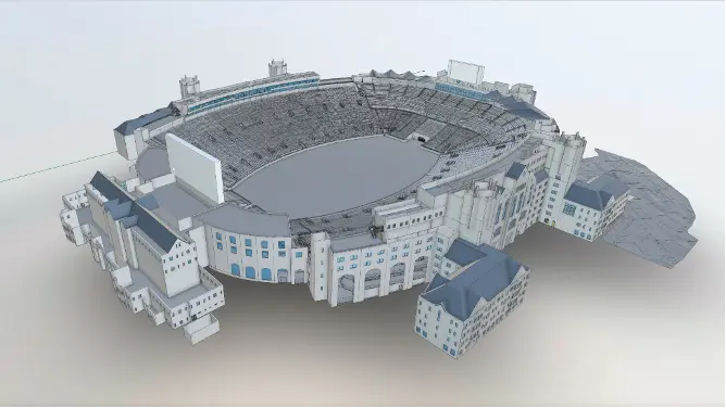
Upon the completion of the scans, the data is stitched together and forms a point cloud of the area. The point cloud consists of millions of data points that serve as the template that our Mapping & Modeling Team will use to create 2D CAD drawings, 3D BIM models, and, in this case, at-depth models.
One factor that is crucial when creating at-depth models is the surface’s terrain. When asked about its importance, GPRS Modeling Lead Adam Silbaugh said:
“Everything is dependent on the terrain. The measurements that they take in one area could be different from another. If the area is slightly tilted, five feet over in one corner is not the same as five feet in the other. So, getting that information is incredibly important so that we can put those measurement marks where they need to be."

How Can an At-Depth Model Benefit My Next Project?
When asked what one of the biggest benefits is when utilizing at-depth models, Silbaugh said, “Having that visual representation of what's going on underneath the ground.”
GPRS is constantly in pursuit of 100% subsurface damage prevention. At-depth modeling serves as another steppingstone towards that ultimate goal.
Every 60 seconds, there is a utility strike in the United States. By knowing what is below your feet before you dig eliminates the possibility of striking utilities that can lead to expensive repairs, costly delays, and serious injuries or death.
The data presented in at-depth models clearly depict the location of underground utilities and obstructions so your next project and every project after that can progress without the risk of utility strikes.
Thank you for reading this excerpt. You can learn more about the benefits of as-depth modeling by reading the full article here.
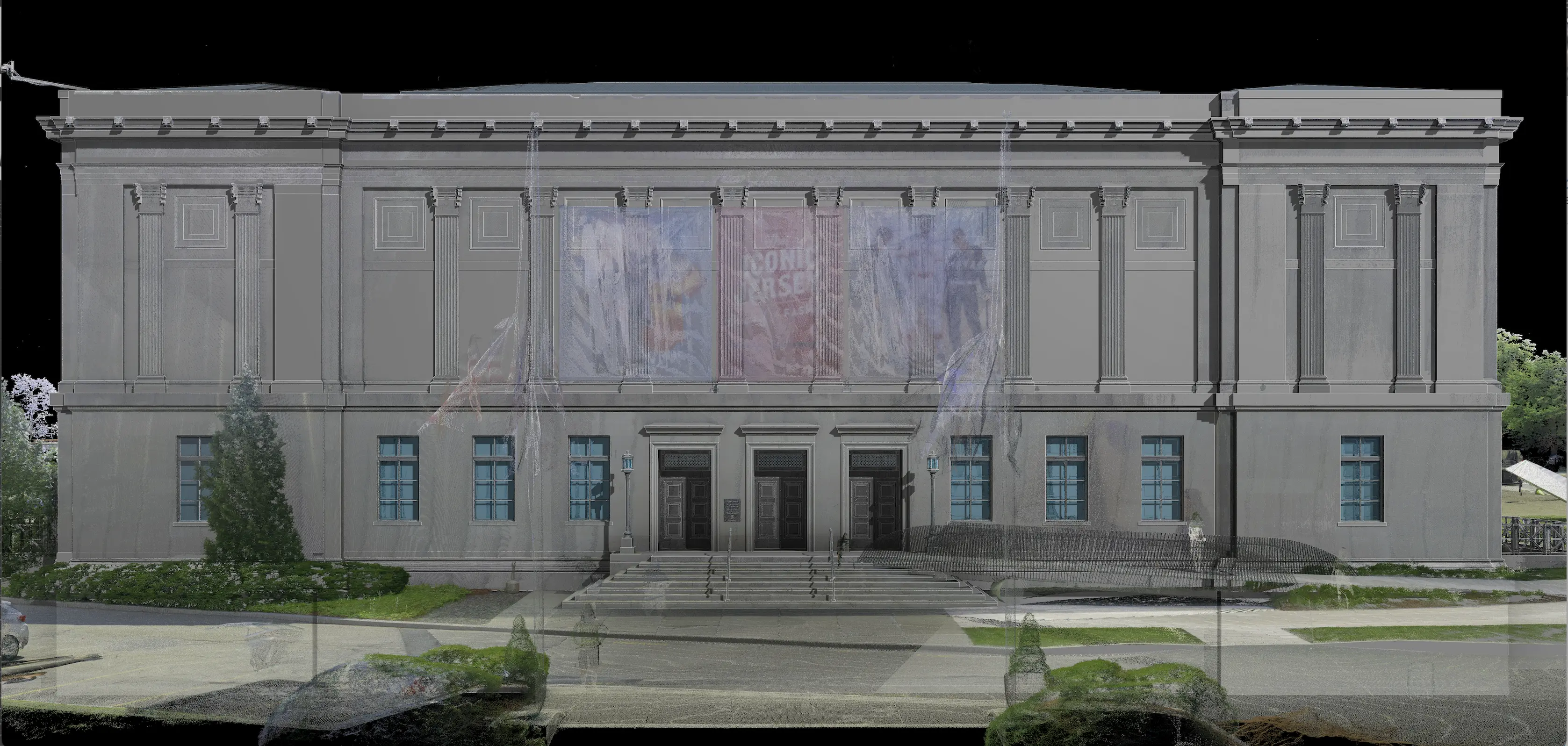
Over the past 27 years, Existing Conditions has measured, documented, and modeled over 10,000 buildings spanning over 700 million square feet across the United States, establishing ourselves as an industry leader in reality capture. Architects, builders, engineers, developers, and facility managers trust us to deliver digital representations of the as-built environment with unparalleled accuracy and efficiency. Our services, including 3D laser scanning, 3D photogrammetry, and BIM modeling Visualize The Built World® to enable architects to make informed design decisions based on the most accurate data available.
FAQs
Related Articles